Lemosho Route Kilimanjaro
Kilimanjaro’s Most Scenic Climb
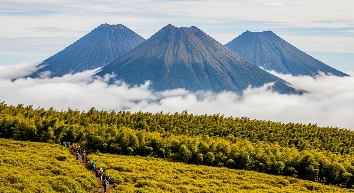
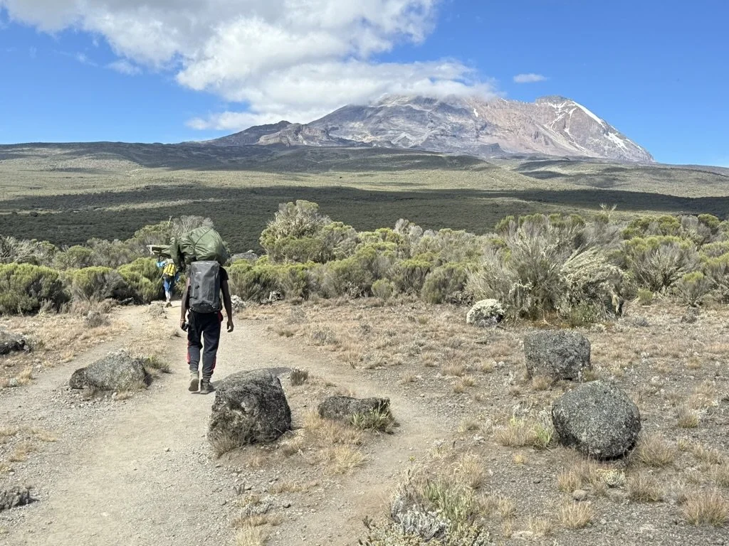
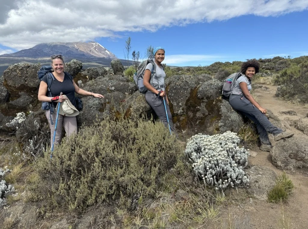
The Lemosho route is widely regarded as the most beautiful way to climb Mount Kilimanjaro. Starting from the remote western slopes, this 8-day itinerary passes through five distinct ecological zones — from dense montane rainforest alive with colobus monkeys and orchids, across the ancient Shira Plateau, past the dramatic Lava Tower, up the legendary Barranco Wall, and through the stark alpine desert to the glaciers and crater rim at Uhuru Peak, 5,895 meters above sea level.
With an industry-wide summit success rate of approximately 90%, the 8-day Lemosho offers the ideal balance of strong acclimatization, manageable daily distances, and scenery that no other route on the mountain can match. It is Duma Explorer’s most popular climb and our top recommendation for most climbers.
Duration: 8 Days / 7 Nights
Distance: ~70 km (42 miles)
Summit Elevation: 5,895m / 19,341 ft
Success Rate: ~90% (industry average)
Difficulty: Moderate (non-technical)
Best Months: June – October, January – February
Starting Price: From $2,799 per person
Max Group Size: 8 climbers
IN THIS GUIDE
Lemosho Route | Day-by-Day Itinerary | Photos | Route Summary | Pricing | Kilimanjaro Itineraries | FAQ | Resources
Five Worlds in Eight Days
Kilimanjaro’s Ecological Zones on the Lemosho Route
Montane Rainforest (1,800–2,800m)
Your climb begins in a dense, cathedral-like rainforest. Towering camphorwood and yellowwood trees stretch 40 meters overhead, their branches draped in hanging mosses and epiphytic orchids. The air is warm and humid. Black-and-white colobus monkeys crash through the canopy above while blue monkeys forage closer to the trail. Listen for the calls of Hartlaub’s turacos and silvery-cheeked hornbills. The Lemosho trailhead is one of the quietest on the mountain — you may not see another climbing group all day.
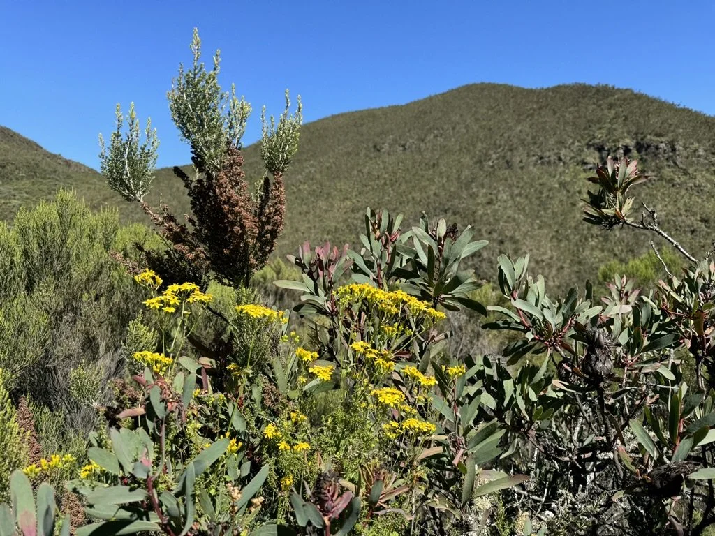
Heath and Moorland (2,800–4,000m)
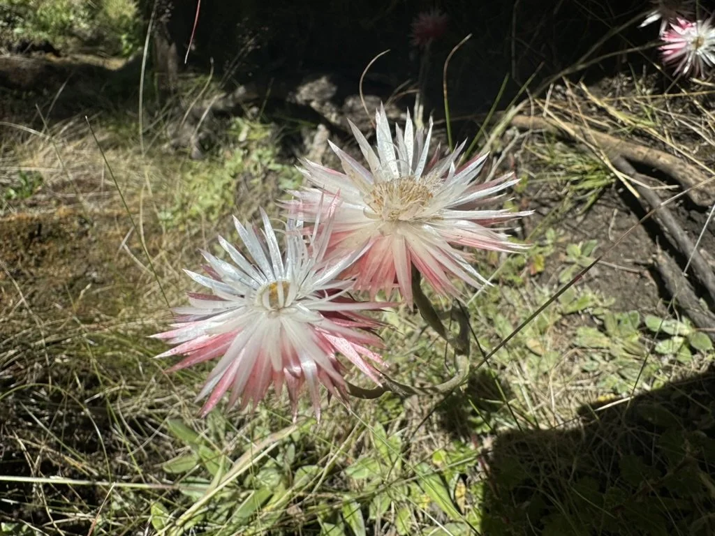
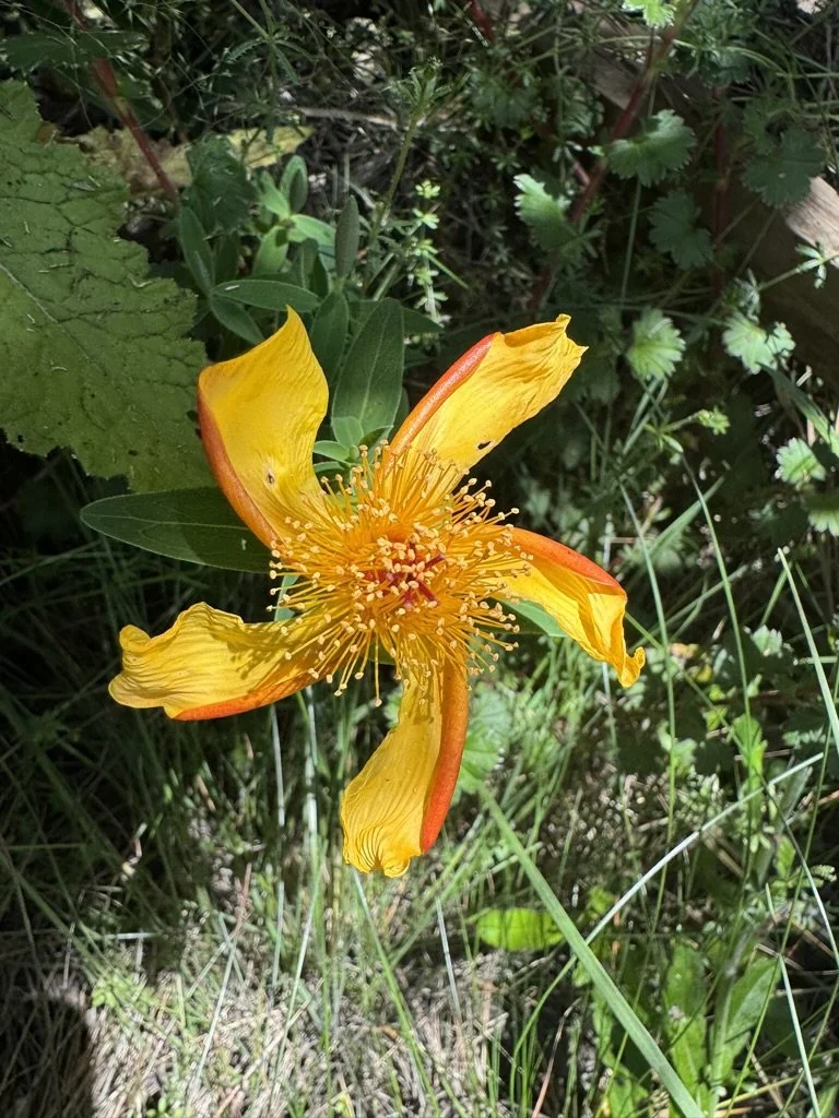
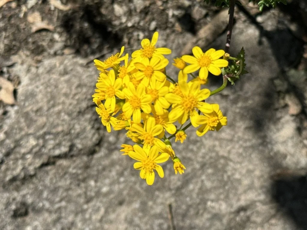
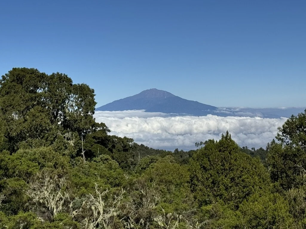
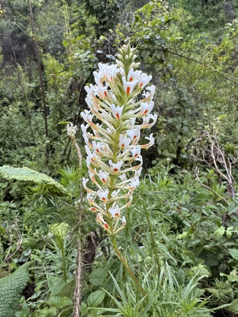
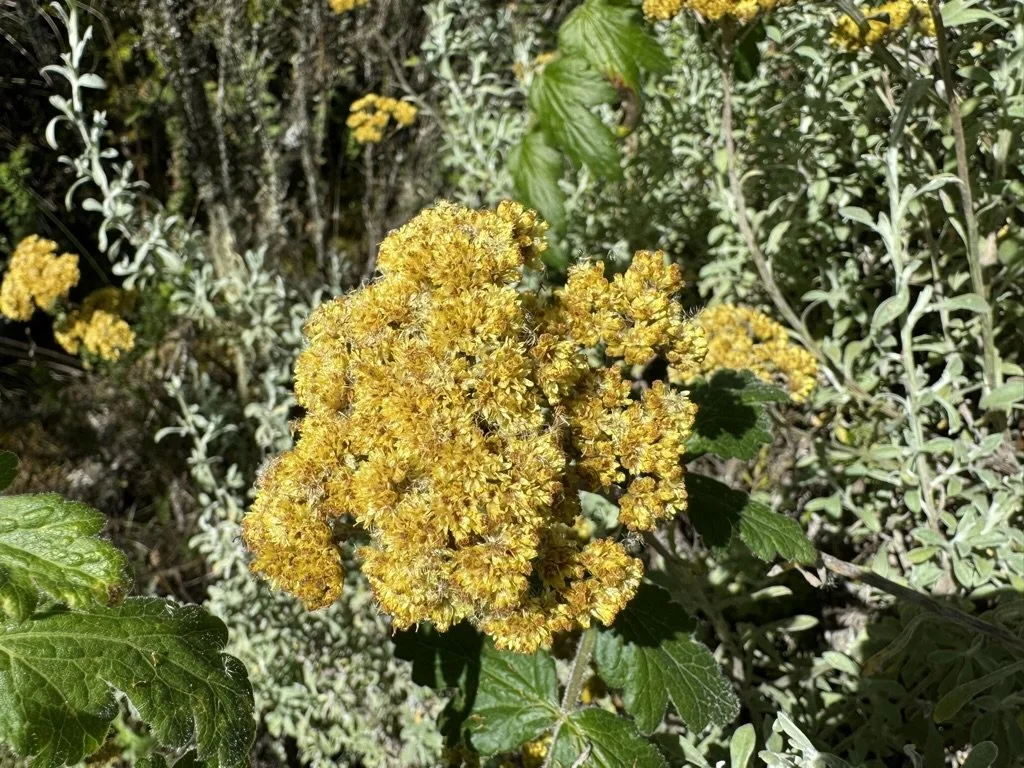
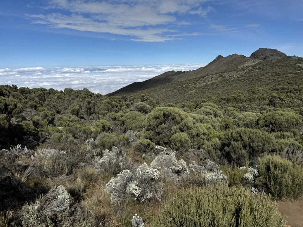
As the forest thins, the landscape opens into rolling moorland dotted with giant heather trees, tussock grasses, and colorful wildflowers. This is where you first encounter Kilimanjaro’s endemic plant life: giant lobelias with their tall flowering spikes and the early specimens of giant groundsels. The views transform — Kibo’s snow-streaked summit appears ahead, and on clear days, Mount Meru floats above the clouds to the west. The Shira Plateau, a vast ancient caldera, stretches before you.
Alpine Desert (4,000–5,000m)
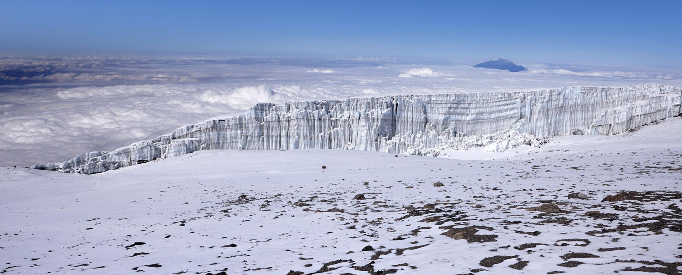
Above 4,000 meters, vegetation all but disappears. The landscape becomes stark and otherworldly — volcanic rock, loose scree, and a silence broken only by wind. Daytime temperatures can still reach 30°C in direct sun, but nighttime lows plunge well below freezing. Near Lava Tower and in the Barranco Valley, towering giant groundsels (Senecio kilimanjari) stand like alien sentinels, their thick trunks and rosette crowns adapted to these extreme temperature swings. The glaciers on Kibo’s southern face become visible — the Kersten and Decken ice fields glinting in the afternoon light.
Arctic / Summit Zone (5,000m+)
Summit night takes you into Kilimanjaro’s arctic zone — a lunar landscape of rock, ice, and thin air holding roughly half the oxygen of sea level. As you reach Stella Point on the crater rim at sunrise, the remaining glaciers glow orange and gold, the volcanic crater opens below you, and the African plains stretch to the horizon in every direction. The final walk along the crater rim to Uhuru Peak is the culmination of everything the Lemosho route has been building toward.
Day-by-Day Itinerary
Each day on the 8-day Lemosho route is designed with purpose. The first three days build your acclimatization gradually through the forest and across the Shira Plateau. Day 4 is the critical “climb high, sleep low” day at Lava Tower. Days 5 and 6 consolidate your altitude adaptation before the summit push. Day 7 is summit night. Day 8 brings you back down through the forest to Mweka Gate and your hotel.
-
2,380m to 2,900m • 6 km • 3–4 hours • Montane Rainforest
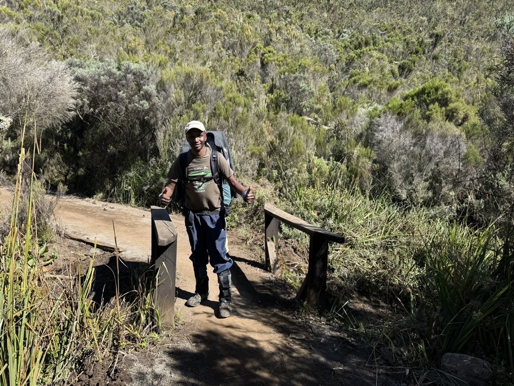
Your Kilimanjaro climb begins with an early morning departure from your hotel in Moshi or Arusha. The drive to Londorossi Gate takes approximately three to four hours, winding through coffee and banana plantations on the lower slopes of the mountain. After a brief stop to register and pay forest fees, your vehicle continues along a rough dirt track for another 12 kilometers to the Lemosho trailhead.
The trail enters Kilimanjaro’s montane rainforest immediately — a dense, cathedral-like canopy of camphorwood, yellowwood, and wild fig trees draped in hanging mosses and epiphytic orchids. The air is warm and humid. Listen for the crashing movement of black-and-white colobus monkeys swinging through the upper branches, and watch for blue monkeys foraging closer to the ground. Silvery-cheeked hornbills and Hartlaub’s turacos flash between the trees overhead.
This is one of the quietest starting points on the mountain. Unlike the Machame or Marangu gates, you are unlikely to see another climbing group all day. The trail is gentle and well-shaded, rising gradually through the forest to Forest Camp (also called Mti Mkubwa, meaning “Big Tree” in Swahili). Settle into camp surrounded by towering trees as your crew prepares your first mountain dinner.
Overnight: Forest Camp (Mti Mkubwa) — 2,900m / 9,500 ft
-
2,900m to 3,510m • 8 km • 5–6 hours • Rainforest to Heath/Moorland
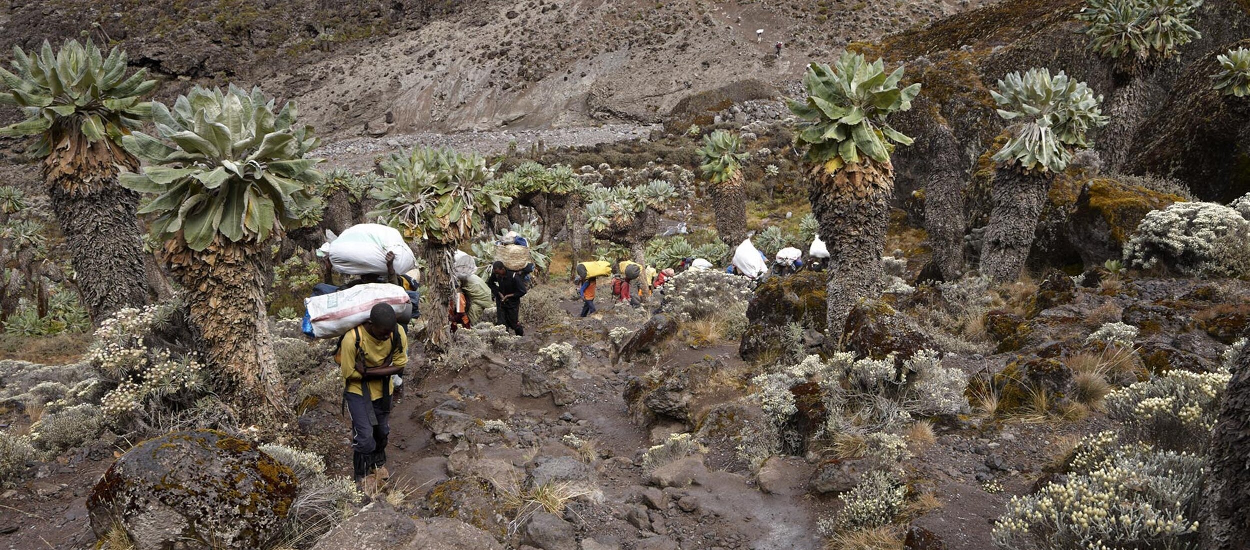
Today the landscape transforms as you leave the rainforest behind and enter Kilimanjaro’s heath and moorland zone. The dense canopy gives way to giant heather trees, some reaching four meters tall, interspersed with wildflowers, tussock grasses, and the first scattered specimens of Kilimanjaro’s endemic giant groundsels.
As the trail climbs and the vegetation thins, the views open dramatically. For the first time, you catch an unobstructed view of Kibo’s snow-streaked peak rising above the moorland. On clear days, you can look west toward Mount Meru floating above the cloud layer.
The trail flattens as you approach the western edge of the Shira Plateau — a vast, ancient caldera formed when Kilimanjaro’s oldest volcanic cone collapsed roughly 500,000 years ago. The plateau stretches out ahead of you, open and windswept, with Kibo dominating the eastern horizon.
Overnight: Shira 1 Camp — 3,510m / 11,500 ft
-
3,510m to 4,140m • 14 km • 5–7 hours • Moorland to Alpine Desert
This is a long but rewarding traverse across the Shira Plateau — one of the most scenic stretches on the entire mountain. The trail crosses open moorland dotted with giant lobelias and groundsels, with Kibo’s glaciated summit ahead and the jagged profile of Shira Cathedral rising to the south.
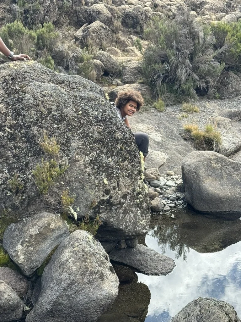
After passing through Shira 2 Camp, the trail climbs gradually toward Moir Hut, tucked into a sheltered valley beneath the Lent Group. The vegetation grows sparser as you transition from moorland into the lower reaches of the alpine desert. The landscape feels increasingly otherworldly — volcanic rock, scattered boulders, and a silence broken only by wind.
Moir Hut is one of the least-used campsites on Kilimanjaro, meaning you will likely have the area to yourself. At sunset, look west from camp — on exceptionally clear evenings, you may see the faint glow of Ol Doinyo Lengai, Tanzania’s only active volcano, over 100 kilometers distant.
Overnight: Moir Hut — 4,140m / 13,580 ft
-
4,140m to 4,600m to 3,950m • 7 km • 4–6 hours • Alpine Desert
Today is the most important acclimatization day of the climb. The principle is simple: climb high, sleep low. You will ascend to the base of Lava Tower at 4,600 meters before descending steeply to Barranco Camp at 3,950 meters. Although you end the day lower than you started, the time spent at altitude primes your body for the days ahead.
Lava Tower is a dramatic 90-meter volcanic plug jutting from the mountainside — a remnant of Kilimanjaro’s volcanic past, formed when molten lava hardened inside an ancient vent. From its base, the views are sweeping: the Shira Plateau behind you, the Western Breach and Arrow Glacier above, and the Southern Icefields glinting in the afternoon sun.
The descent from Lava Tower to Barranco Camp drops through a valley of giant groundsels (Senecio kilimanjari), some towering five meters tall. These alien-looking plants, with their thick trunks and rosette crowns, thrive in this zone where daytime temperatures can reach 30°C and nighttime temperatures plunge well below freezing.
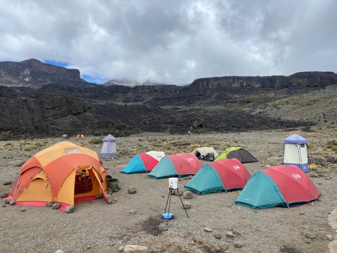
Barranco Camp is widely regarded as the most beautiful campsite on Kilimanjaro. It sits in a natural amphitheater beneath the imposing Barranco Wall, with views of the glaciers clinging to Kibo’s southern face. Watch the sunset paint the ice fields gold from your tent.
Overnight: Barranco Camp — 3,950m / 12,960 ft
-
3,950m to 4,000m • 5 km • 4–5 hours • Alpine Desert
The day begins with the climb everyone has been talking about: the Barranco Wall. Rising 257 meters above camp, the wall looks intimidating from below — but it is a scramble, not a technical climb. No ropes or harnesses are needed. Your guides know every handhold and will be right beside you, pointing the way.
The ascent takes roughly an hour of steady scrambling, with a few sections where you use your hands to pull yourself up. Once you reach the top, the sense of achievement is immediate — and the views from the ridge are among the best on the mountain. The Kersten and Decken glaciers hang above you, and on a clear morning, the shadow of Kilimanjaro stretches across the plains below.
From the top of the wall, the trail traverses a series of ridges and valleys before a short, steep descent into the Karanga Valley. This is an intentionally short day designed to consolidate your acclimatization before the push to high camp tomorrow. Use the afternoon to rest, hydrate, and enjoy the views.
Overnight: Karanga Camp — 4,000m / 13,100 ft
-
4,000m to 4,670m • 4 km • 4–5 hours • Alpine Desert
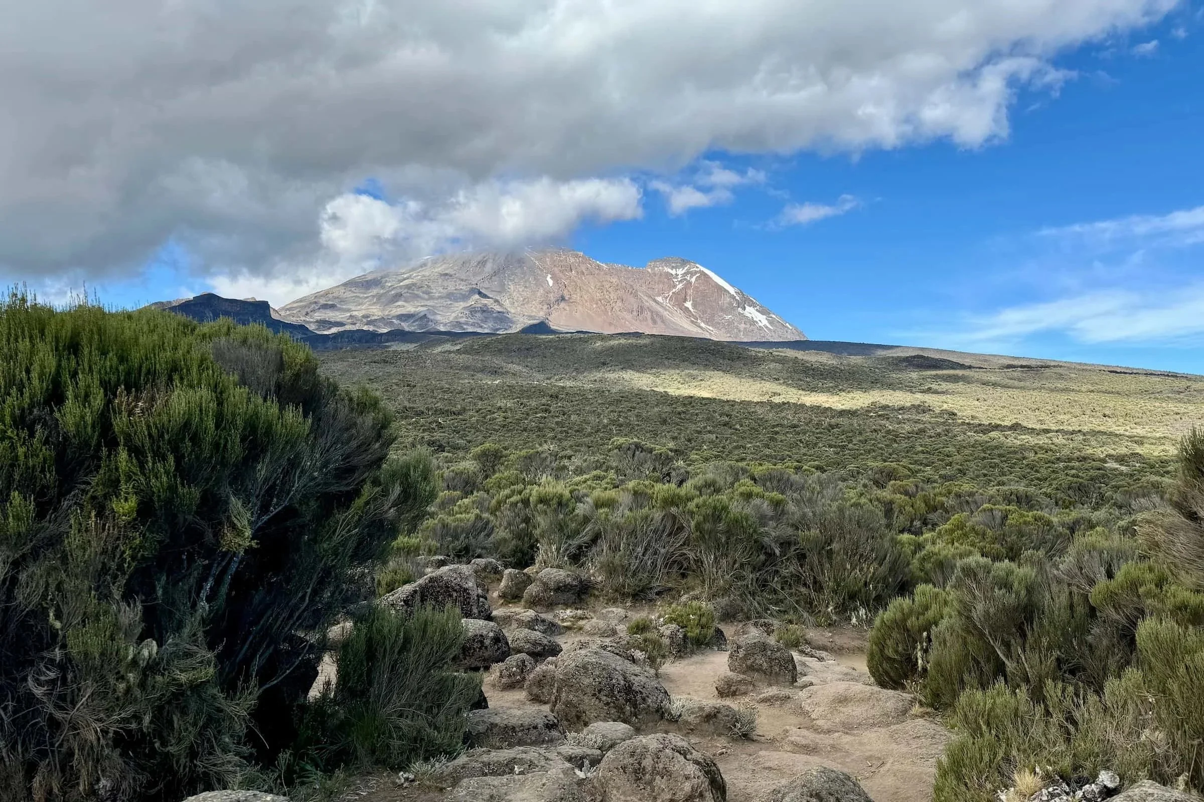
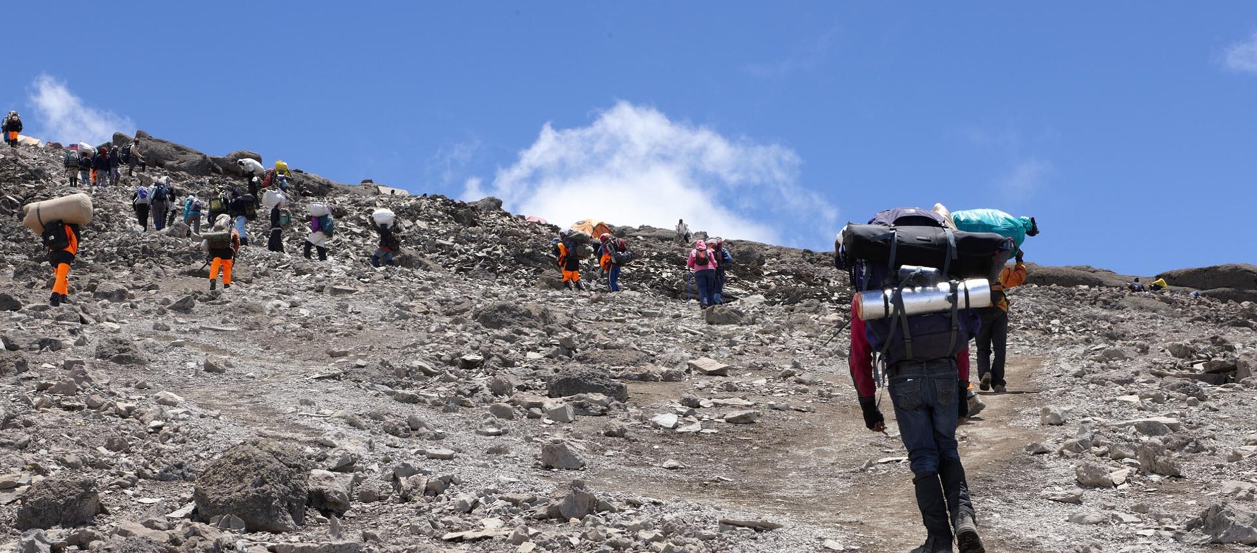
Today you climb to Barafu Camp, your base for the summit attempt. The trail ascends steadily through the upper alpine desert — a stark, rocky landscape almost entirely devoid of vegetation. The air is noticeably thinner, and the temperature drops sharply once the sun dips behind clouds.
Along the way, you pass the junction where the Mweka descent route branches off — you will return this way tomorrow after summiting. The trail offers dramatic views of Kibo’s glaciated southern face, with the remnants of the Rebmann Glacier visible to the east and the Kersten and Decken glaciers above.
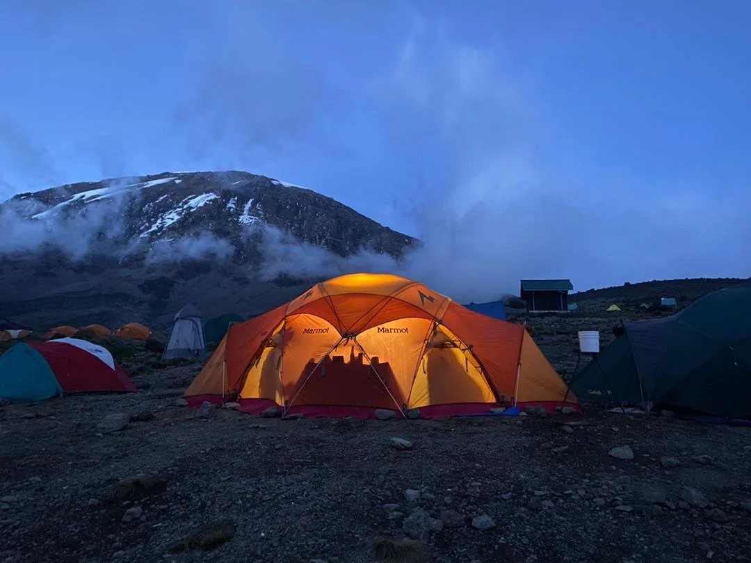
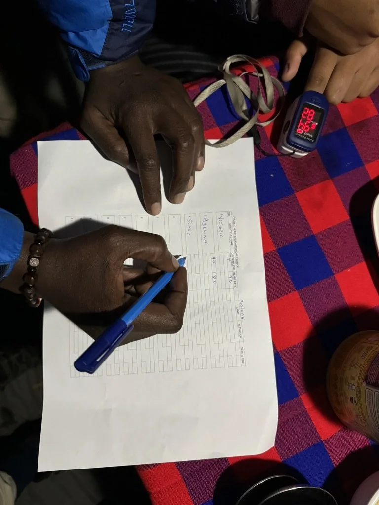
Barafu Camp sits on an exposed, rocky ridge. The name means “ice” in Swahili — fitting, as nighttime temperatures routinely drop below minus 15°C. Your crew will have hot drinks waiting when you arrive. Eat an early dinner and try to sleep by 6 or 7 pm. Your summit wake-up call comes before midnight.
Overnight: Barafu Camp — 4,670m / 15,300 ft
-
4,670m to 5,895m to 3,100m • 15.5 km • 12–15 hours • Arctic / Alpine Desert / Moorland
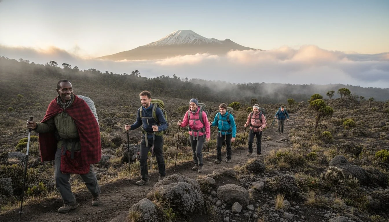
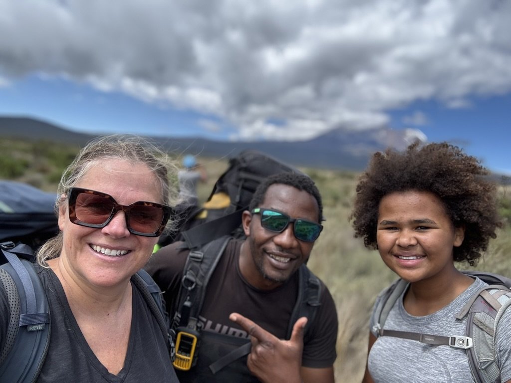
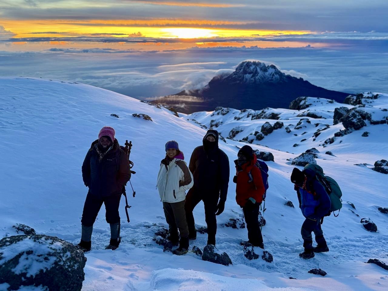
You wake around 11:30 pm to hot tea and biscuits. By midnight, you are moving. Headlamp on, warm layers zipped up, one foot in front of the other. A dedicated Duma crew member walks with you throughout the ascent — a 1:1 staff-to-climber ratio that ensures every person has individual support when it matters most.
The trail zigzags up steep scree slopes in the darkness. This is the most physically demanding stretch of the climb, not because of technical difficulty, but because of the altitude and cold. The air holds roughly half the oxygen of sea level. Your crew member will set the pace, encourage you to eat and drink, and monitor how you are coping.
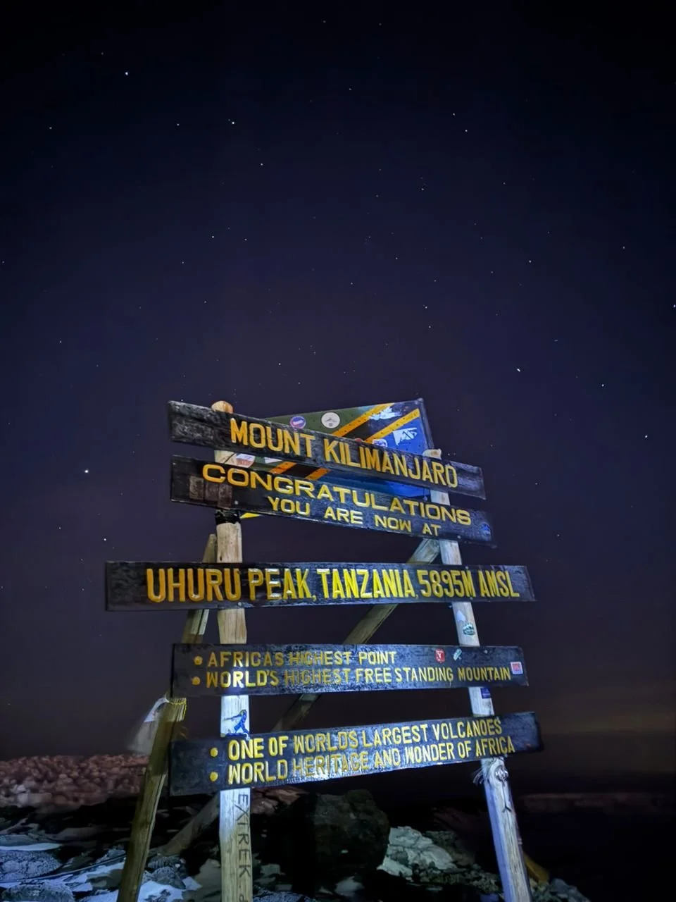
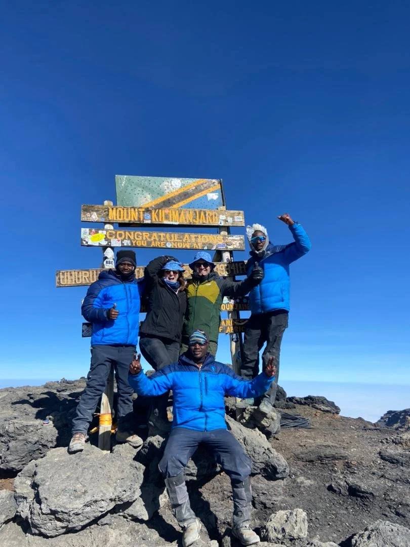
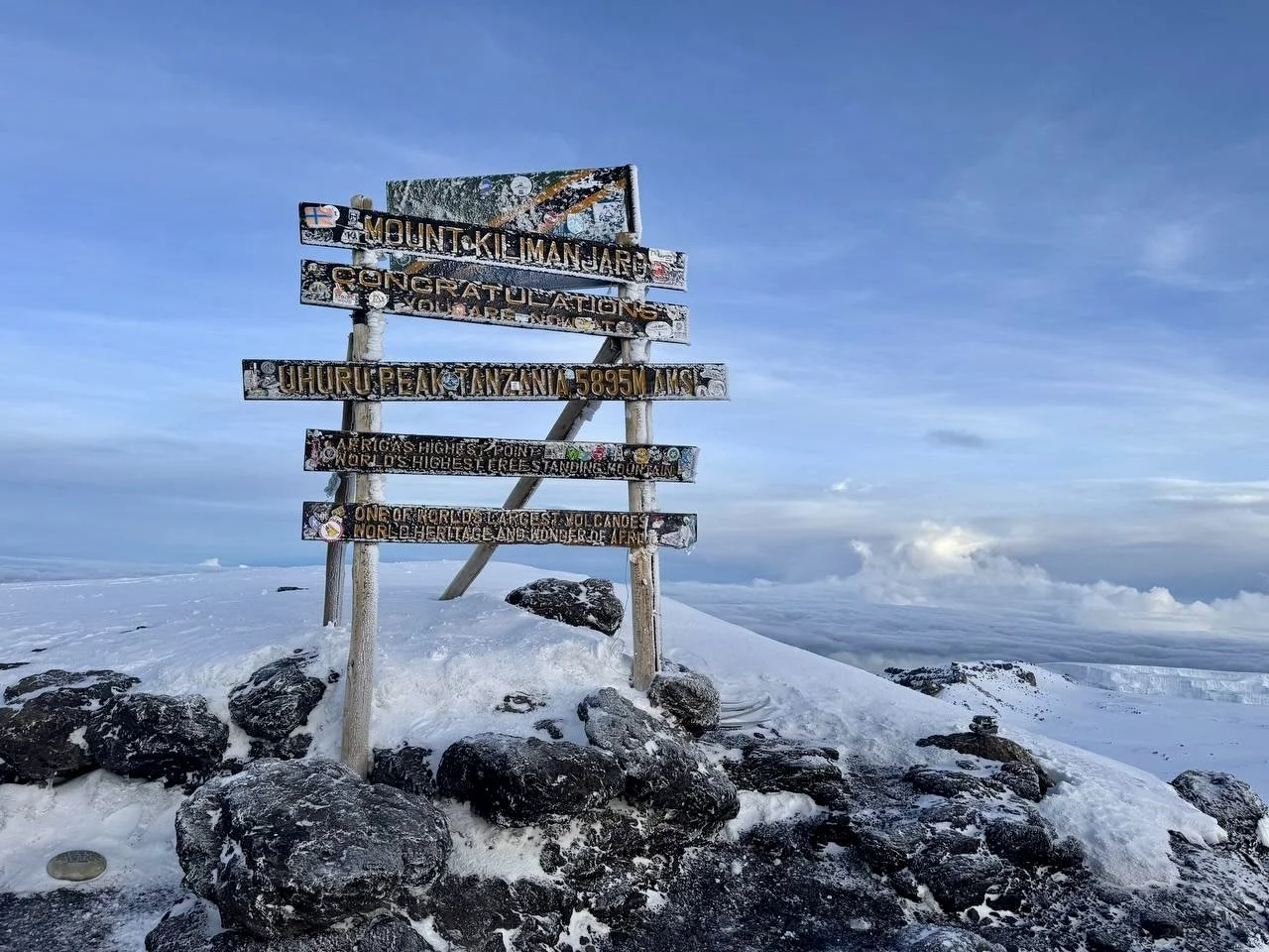
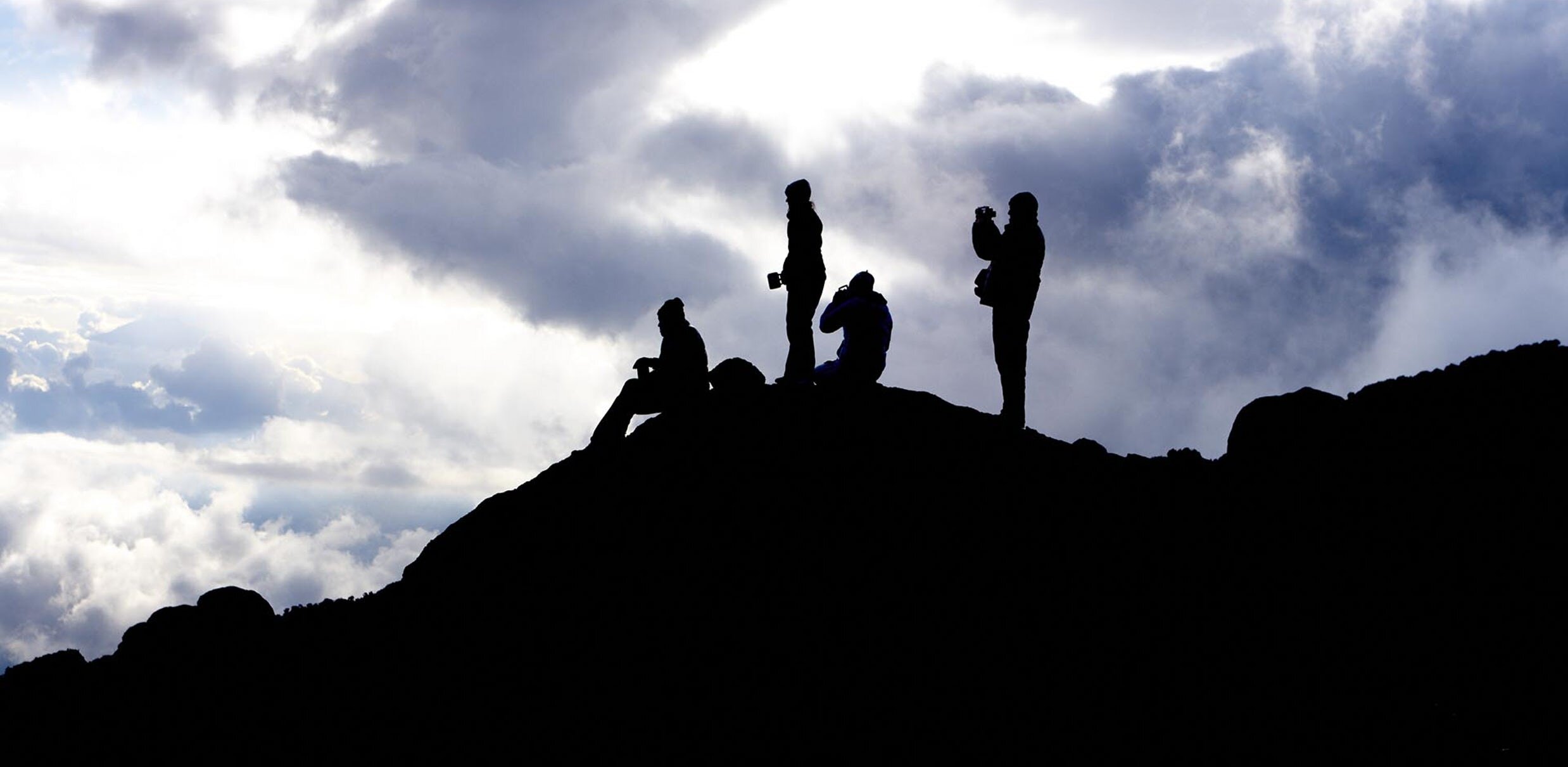
Around sunrise, you reach Stella Point at 5,752 meters on the crater rim. The reward is immediate: the African plains stretch to the horizon, the remaining glaciers glow in the early light, and the volcanic crater opens below you. From Stella Point, it is a 45-minute walk along the crater rim to Uhuru Peak — 5,895 meters, the highest point in Africa. Celebrate, take your photos, and soak it in.
The descent is long but fueled by adrenaline. You return to Barafu Camp for brunch and a rest, then continue down through the alpine desert and back into the moorland to reach Mweka Camp by evening.
Overnight: Mweka Camp — 3,100m / 10,170 ft
-
3,100m to 1,650m • 10 km • 3–4 hours • Rainforest
Your final morning on Kilimanjaro. After breakfast, the trail descends through the moorland and re-enters the montane rainforest. The air grows warmer and more humid with every step. After days in the stark alpine desert and arctic zone, the lush green canopy, birdsong, and the smell of damp earth feel like arriving in a different world.
The descent to Mweka Gate takes three to four hours on a well-maintained trail. At the gate, your guides and porters will be waiting to celebrate with you. This is where you receive your summit certificate — a green certificate for Uhuru Peak, gold for Stella Point. Tip your crew, buy a cold soda or souvenir, and enjoy a picnic lunch before the drive back to your hotel in Moshi.
Most climbers arrive back at their hotel by late afternoon, leaving time for a hot shower, a proper meal, and the deep satisfaction of having stood on the roof of Africa.
End: Mweka Gate — 1,650m / 5,400 ft


| Day | Highlights | Start Elevation | End Elevation | Gain / Loss | Distance | Overnight Camp | Zone |
|---|---|---|---|---|---|---|---|
| Day 1 | Drive to Londorossi Gate; trek through montane rainforest; colobus monkeys, orchids, hanging mosses | 2,380m | 2,900m | +520m | 6 km | Forest Camp | Rainforest |
| Day 2 | Forest to moorland transition; giant heather, first views of Kibo peak and Mount Meru | 2,900m | 3,510m | +610m | 8 km | Shira 1 Camp | Moorland |
| Day 3 | Shira Plateau traverse; giant lobelias, Shira Cathedral; sunset views toward Ol Doinyo Lengai | 3,510m | 4,140m | +630m | 14 km | Moir Hut | Moorland |
| Day 4 | Key acclimatization day; Lava Tower (4,600m); giant groundsels; Barranco Valley descent | 4,140m | 3,950m | +460m / –650m | 7 km | Barranco Camp | Alpine Desert |
| Day 5 | Barranco Wall scramble (257m); ridge-top glacier views; Karanga Valley | 3,950m | 4,000m | +50m | 5 km | Karanga Camp | Alpine Desert |
| Day 6 | Ascent to high camp; Rebmann, Kersten & Decken glacier views; Mweka junction | 4,000m | 4,670m | +670m | 4 km | Barafu Camp | Alpine Desert |
| Day 7 | Summit night; Stella Point sunrise; Uhuru Peak (5,895m) — roof of Africa; descent to Mweka | 4,670m | 3,100m | +1,225m / –2,795m | 15.5 km | Mweka Camp | Arctic |
| Day 8 | Final descent through cloud forest; summit certificates at Mweka Gate; drive to hotel | 3,100m | 1,650m | –1,450m | 10 km | — | Rainforest |
Route Summary Table
Pricing, Inclusions & Exclusions
What’s Included & What’s Not
Included in Your Climb
- All Kilimanjaro National Park entrance and camping fees
- Tanzania forest fees (Lemosho route)
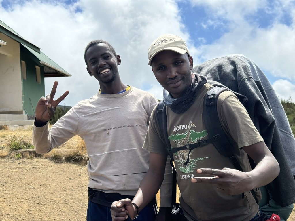
- WFR-certified head guide with 7+ years of Kilimanjaro experience
- Assistant guides and porters
- Professional mountain cook
- All meals on the mountain (breakfast, lunch, dinner, and snacks)
- Filtered drinking water
- Four-season mountaineering tents
- Sleeping mats
- Private toilet tent
- Emergency oxygen cylinder and pulse oximeter
- Daily health monitoring and vitals checks
- 1:1 staff-to-climber ratio on summit night
- Round-trip hotel-to-trailhead transport (Moshi or Arusha)
- Post-climb summit certificate
Not Included
- International flights
- Tanzania visa (available on arrival, ~$50 USD)
- Travel and evacuation insurance (required)
- Personal hiking gear and clothing
- Sleeping bag (rental available)
- Trekking poles (rental available)
- Tips for guides, porters, and cook
- Pre- and post-climb hotel accommodation
- Meals in town before and after the climb
- Souvenirs and personal expenses
- Optional Diamox (altitude sickness medication)
2026 Lemosho Route Pricing — Published and Transparent
All prices are per person in USD. No hidden fees or surcharges.
Contact us to discuss your group size, dates, and any custom requirements.
Frequently Asked Questions
-
The Lemosho route is widely considered the most scenic route on Mount Kilimanjaro. It approaches from the western side of the mountain, beginning in remote montane rainforest and crossing the ancient Shira Plateau before joining the Southern Circuit toward the summit. The 8-day Lemosho itinerary is Duma Explorer’s most popular climb and our top recommendation for most climbers, offering an approximately 90% summit success rate, strong acclimatization, and diverse scenery across five distinct ecological zones.
-
The 8-day Lemosho route starts at a lower elevation (2,380 meters at Londorossi Gate) and includes an extra day trekking through the montane rainforest to Forest Camp. The 7-day version skips this first day and begins the hike at a higher trailhead around 3,400 meters. That extra day gives your body more time to acclimatize gradually, which is why the 8-day route has a higher summit success rate — approximately 90% compared to roughly 85% for the 7-day. Duma Explorer recommends the 8-day itinerary for most climbers, especially first-time high-altitude trekkers.
-
The industry-wide summit success rate for the 8-day Lemosho route is approximately 90%, making it one of the highest of any Kilimanjaro route. The 7-day Lemosho has a success rate of roughly 85%. Duma Explorer’s rates are consistently higher than industry averages thanks to a 1:1 staff-to-climber ratio on summit night, WFR-certified guides, and proven acclimatization protocols.
-
The drive from Usa River to Londorossi Gate takes approximately three hours. From Arusha, add another hour to an hour and a half. The road passes through coffee and banana plantations on the lower slopes of the mountain before reaching the gate area, where the last stretch is on a rough dirt road requiring a 4x4 vehicle. At Londorossi Gate, your operator registers the climb and pays park entrance fees and forest fees. After registration, you drive another 12 kilometers along a forest track to the actual trailhead where the hike begins.
-
The Lemosho route is rated moderate in difficulty. It is not a technical climb — no ropes, harnesses, or mountaineering experience are required. The main physical challenge is the Barranco Wall on Day 5, a 257-meter scramble where you use your hands in places, but it is non-technical and fully guided. The greatest challenge overall is the altitude, particularly on summit night when you climb from 4,670 meters to 5,895 meters. Choosing the 8-day itinerary gives your body the best chance to acclimatize.
-
The Lemosho route passes through five of Kilimanjaro’s ecological zones: montane rainforest with colobus monkeys, orchids, and hanging mosses; heath and moorland with giant heather and wildflowers; the vast Shira Plateau with panoramic views of Kibo and Mount Meru; alpine desert with volcanic rock and giant groundsels near Lava Tower; and the arctic summit zone with glaciers and crater views at sunrise. Key landmarks include Shira Cathedral, Lava Tower, the Barranco Wall, and the Kersten and Decken glaciers.
-
The Barranco Wall is not dangerous when climbed with experienced guides. It is a 257-meter non-technical scramble that takes about one hour to ascend. There are sections where you use your hands for balance, but no ropes or climbing equipment are needed. Duma Explorer’s guides know every handhold on the wall and walk alongside you throughout the scramble. It looks more intimidating from below than it is in practice.
-
The best months are during the long dry season from June through October, with July through September offering the most stable weather. January and February are also popular but rainfall can be more variable. Avoid the heavy rains of April and May. The Lemosho trailhead in the rainforest zone can be muddy even during dry season, so waterproof boots are essential year-round.
-
Duma Explorer’s 2026 pricing for the 8-day Lemosho route starts at $2,799 per person for groups of eight or more, $2,999 per person for groups of four to seven, and $3,399 per person for groups of two to three. The 7-day Lemosho starts at $2,399 per person for groups of eight or more and goes up to $2,999 for two to three people. All prices include park fees, meals, camping equipment, WFR-certified guides, porters, emergency oxygen, and transport. No hidden surcharges.
-
All Duma Explorer Lemosho climbs include park entrance and camping fees, forest fees, all meals on the mountain (breakfast, lunch, dinner, and snacks), four-season mountaineering tents, sleeping mats, a private toilet tent, WFR-certified head guide, assistant guides, porters, a cook, emergency oxygen and a pulse oximeter, daily health monitoring, round-trip hotel-to-trailhead transport, and a post-climb summit certificate.
-
The Lemosho route is one of the safest routes on Kilimanjaro due to its gradual acclimatization profile. Duma Explorer enhances safety further with WFR-certified head guides who monitor your vitals daily using pulse oximeters, carry emergency oxygen on every climb, and maintain a 1:1 staff-to-climber ratio on summit night. If a serious medical emergency occurs, helicopter evacuation is available through KiliMedAir, with designated landing zones at several camps along the route. We strongly recommend travel insurance that covers high-altitude trekking and helicopter evacuation. Read our complete guide to helicopter evacuation on Kilimanjaro.
Your Lemosho Climb Starts here
Tell Stacy your dates, fitness level, and goals — she’ll match you with the right itinerary, build your crew, and handle every detail from trailhead to summit.
Kilimanjaro Itineraries

Lemosho Shira Route Itinerary
The Northern Circuit Route Itinerary

Machame Route Itinerary
Rongai Route Itinerary
Lemosho Shira via Crater Route Itinerary

Marangu Route Itinerary
Umbwe Route Itinerary
Resources & Blog