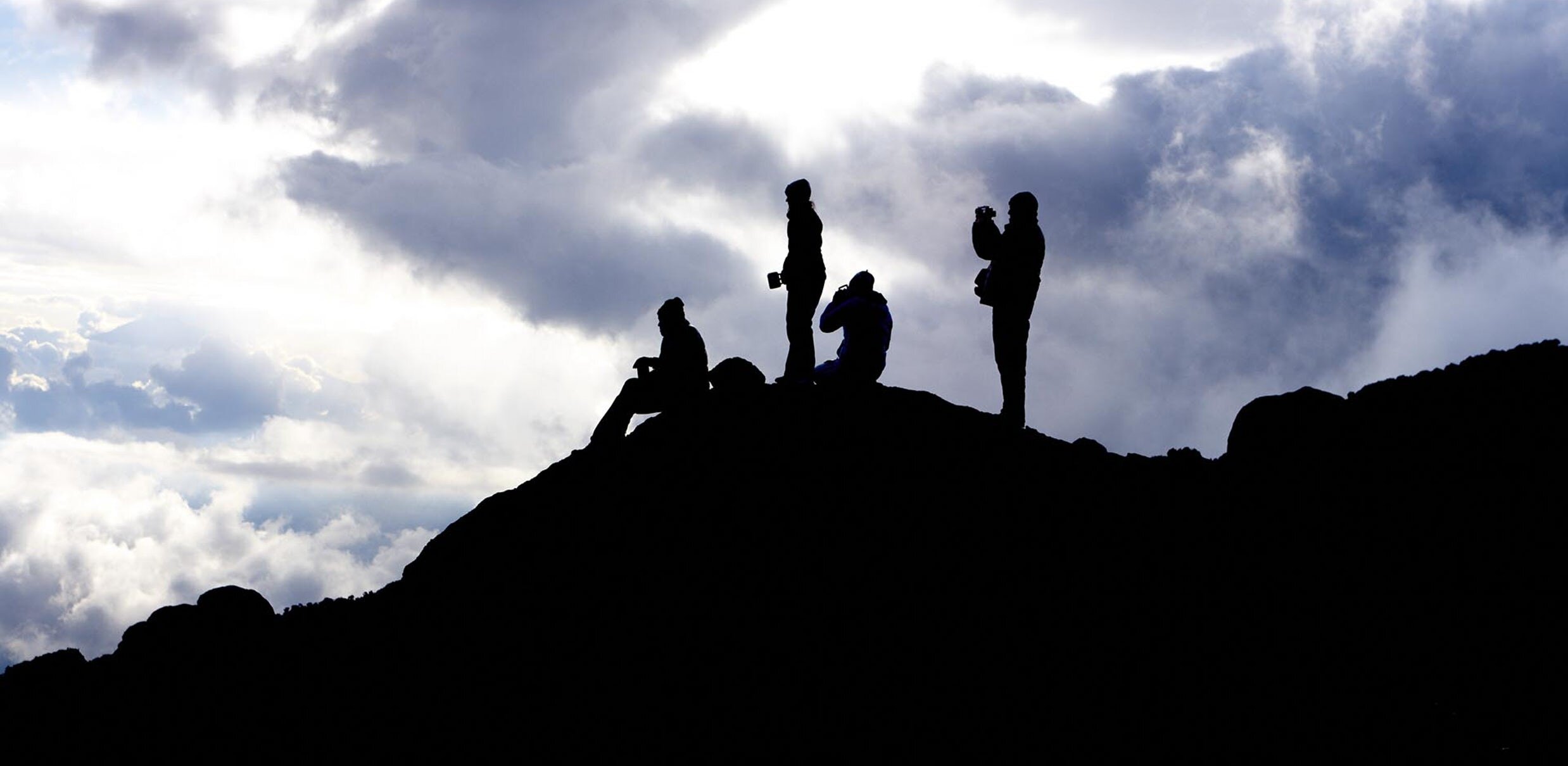
Rongai Route Kilimanjaro
Kilimanjaro’s Quieter Northern Approach
The Rongai route is the only path that approaches Kilimanjaro from the north, beginning near the Kenyan border and traversing the mountain’s drier eastern flank. While the popular Machame and Lemosho routes climb through the lush, rain-soaked southern and western slopes, the Rongai side sits in a natural rain shadow — receiving significantly less precipitation year-round. That makes Rongai the strongest choice for anyone climbing during the long rains of March through May or the short rains of November, when the western routes are at their muddiest.
Beyond the weather advantage, Rongai offers something increasingly rare on Kilimanjaro: quiet trails. Far fewer operators run this route, so you’ll share the path with a fraction of the climbers you’d encounter on Machame or Lemosho. The terrain is gentler, too — no Barranco Wall scramble, no steep valley descents. Instead, the route follows a steady, gradual incline through open moorland and alpine desert before delivering you onto the Saddle, a vast high-altitude plateau stretching between Kilimanjaro’s two volcanic peaks.
The Eastern Climate — Kilimanjaro’s Drier Side
Kilimanjaro’s climate varies dramatically depending on which side of the mountain you climb. Moisture-laden trade winds arrive from the southeast, depositing heavy rainfall on the southern and western slopes. By the time these air currents reach the northern and eastern flanks, they carry far less moisture. The result is a distinctly different environment: the Rongai corridor is drier, with sparser vegetation, more open landscapes, and trails that remain firm even when the western routes turn to mud.
The lower slopes reflect this difference clearly. Where the Machame route begins in dense, dripping montane rainforest, the Rongai route starts amid cultivated farmland that transitions into drier montane forest with pine, cedar, and heather. The canopy is thinner, sunlight filters through more freely, and the air feels lighter from the first step. As you climb higher into the moorland zone, the landscape opens into sweeping grasslands and giant heather rather than the boggy, moss-draped terrain found on the southern face.
Crossing the Saddle — Africa’s Largest High-Altitude Desert
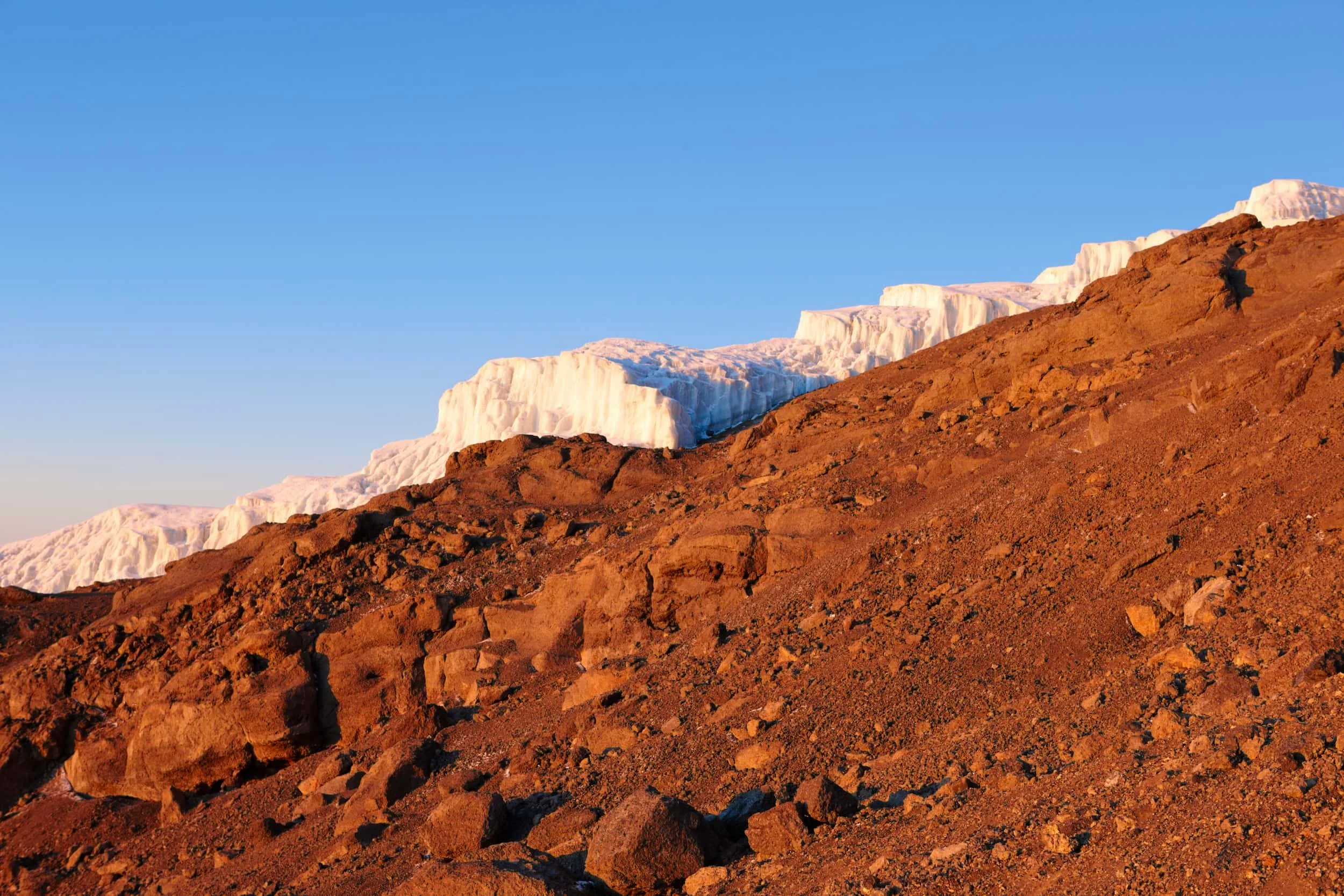
The defining feature of the Rongai route is the Saddle — a 3,600-hectare high-altitude desert plateau that stretches between Kilimanjaro’s two volcanic peaks: Mawenzi (5,149 m) to the east and Kibo (5,895 m) to the west. Sitting at roughly 4,300 to 4,750 meters, it is the largest tropical high-altitude tundra in Africa. The landscape is stark and lunar, with loose volcanic scree, virtually no vegetation, and an immense silence broken only by wind.
You cross the Saddle on Day 5 of the 7-day itinerary, walking from Mawenzi Tarn to Kibo Hut. The trek takes you across this barren expanse with the jagged spires of Mawenzi behind you and the glaciated dome of Kibo rising ahead. It is one of the most visually striking and unique sections of any Kilimanjaro route, and an experience exclusive to the Rongai approach.
Duration: 7 days / 6 nights (recommended) or 6 days / 5 nights
Distance: ~73 km total
Summit Elevation: 5,895m / 19,341 ft
Best For: Rainy-season climbers, those seeking solitude, first-time trekkers wanting a gentler gradient
Difficulty: Moderate — the gentlest ascent profile on Kilimanjaro
Success Rate: ~85% (industry average)
Starting Price: From $2,799 per person
Starting Gate: Rongai Gate (1,950 m) — northern side, near the Kenyan border
IN THIS GUIDE
Rongai Route | Day-by-Day Itinerary | Photos | Route Summary | Pricing | Kilimanjaro Itineraries | FAQ
Four Worlds in Seven Days
Kilimanjaro’s Ecological Zones on the Rongai Route
Cultivated Zone & Montane Forest (1,950 m – 2,800 m)
The route begins at Rongai Gate through farmland and transitions into drier montane forest with pine, podocarpus, and juniper trees. Unlike the southern routes, the forest here is more open and less humid. You may spot black-and-white colobus monkeys, blue monkeys, and a variety of forest birds. The trail is gentle and well-shaded on the first day.
Heath & Moorland (2,800 m – 4,000 m)
Above the treeline, the landscape transitions into open moorland dominated by giant heather, tussock grasses, and everlasting flowers. The eastern moorland is notably drier and more exposed than the western equivalent, offering expansive views toward Kenya on clear days. This zone encompasses the camps at Second Cave and Kikelewa.
Alpine Desert (4,000–5,000m)
Vegetation becomes sparse as you enter the alpine desert. The dramatic highlight of this zone is Mawenzi Tarn, nestled in a natural amphitheatre below the sheer east face of Mawenzi peak. From here, the route crosses the Saddle — an immense, barren plateau between the two peaks — to reach Kibo Hut at 4,750 meters.
Arctic / Summit Zone (5,000m+)
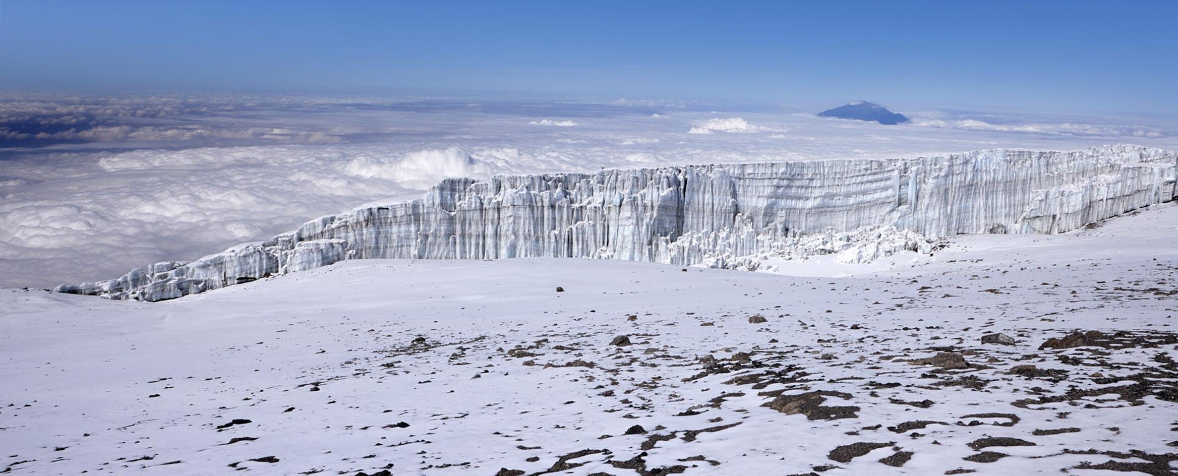
The summit zone is a world of ice, rock, and thin air. From Kibo Hut you ascend through scree to Gilman’s Point on the crater rim, then traverse to Stella Point and finally Uhuru Peak at 5,895 meters. Glaciers and the volcanic crater create an otherworldly landscape at the roof of Africa.

Day-by-Day Itinerary
The 7-day Rongai route is designed to take full advantage of Kilimanjaro’s drier eastern side. Days 1 and 2 climb steadily through montane forest and moorland that feels worlds apart from the lush western slopes. Day 3 is a deliberate acclimatization day with minimal elevation gain. Day 4 delivers the steep ascent to Mawenzi Tarn — one of the most dramatic campsites on the mountain. Day 5 crosses the Saddle, the vast high-altitude desert between Mawenzi and Kibo that is unique to this route. Summit night and the descent via the Marangu route follow on Days 6 and 7.
-
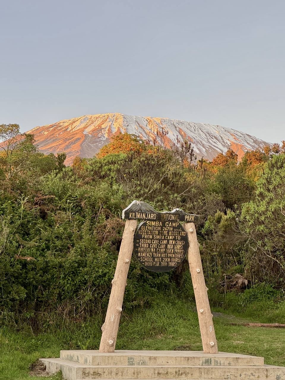
1,950m to 2,600m • 8 km • 4–5 hours • Montane Forest
Your Kilimanjaro climb begins with a morning departure from your hotel in Moshi or Arusha. The drive to Rongai Gate takes roughly two hours from Moshi or three hours from Arusha, passing through the town of Marangu and continuing north toward the Kenyan border through small farming communities. This is the only route that approaches Kilimanjaro from the north, and you’ll notice the landscape becoming drier and more open as you leave the well-watered southern slopes behind.
At the gate (1,950m), your guides register the climb while porters organize gear. Once formalities are complete, the trail begins gently, winding through cultivated farmland with banana groves and maize fields before entering Kilimanjaro’s drier montane forest. Unlike the dripping, cathedral-like rainforest on the Machame and Lemosho routes, the Rongai forest is more open and sunlit, with pine, podocarpus, and juniper trees filtering light onto the path. The canopy is thinner, the air less humid, and the trail noticeably firmer underfoot — a direct result of the rain shadow that shapes the mountain’s eastern climate.
Listen for black-and-white colobus monkeys crashing through the branches overhead and watch for blue monkeys along the forest floor. The gentle gradient makes this an ideal first day to settle into the rhythm of mountain hiking. As the forest thickens, heather and moss begin to appear at the trail’s edges, hinting at the moorland ahead.
Overnight: Simba Camp — 2,600m / 8,530 ft
-
2,600m to 3,450m • 8 km • 5–6 hours • Moorland
The morning begins with a steady climb through the upper forest, where the trees gradually thin and the landscape opens up. As you leave the treeline behind, you enter Kilimanjaro’s heath and moorland zone — but on the eastern side, this zone has a distinctly different character from what climbers encounter on the western routes. The moorland here is noticeably drier, with giant heather, tussock grasses, and clusters of everlasting flowers replacing the boggy, moss-draped terrain found on Machame and Lemosho.
Wide views open in every direction. On clear mornings you can see across the border into Kenya, a reminder of how close you are to the northern frontier. The path follows a broad ridge with gentle undulations, and you’ll catch your first clear, unobstructed view of Kibo’s glaciated dome rising to the west. The air is crisp and the trail firm, a welcome contrast to the muddy conditions that can slow progress on the southern slopes.
Second Cave sits in a sheltered hollow at 3,450 meters, tucked among rocky outcrops that provide natural wind protection. The camp gets its name from a small cave formation nearby. Evenings here are cool and clear, often with spectacular stargazing far from any light pollution.
Overnight: Second Cave — 3,450m / 11,319 ft
-
3,450m to 3,600m • 6 km • 3–4 hours • Moorland
This shorter day is the key advantage of the 7-day itinerary, built in specifically for acclimatization. With only 150 meters of elevation gain, your body gets a full extra day to adjust to the altitude before the steeper climbing ahead. This is one of the main reasons the 7-day Rongai has a significantly higher summit success rate than the 6-day version.
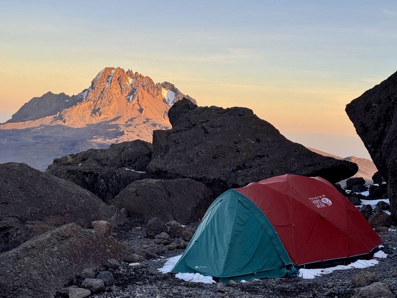
The trail traverses rolling moorland with views of Mawenzi’s jagged, saw-toothed peaks growing more dramatic with every step. Mawenzi is Kilimanjaro’s second summit (5,149m) and one of Africa’s most striking mountain formations — a crumbling volcanic remnant with sheer rock faces and deep gullies. The vegetation becomes sparser as you gain altitude, transitioning from dense heather into scrubby alpine grassland dotted with lobelia and groundsel.
Kikelewa Camp sits at 3,600 meters in a broad, open valley. Your guides will monitor your vitals with pulse oximeters and may lead an optional acclimatization walk in the afternoon, helping your body prepare for tomorrow’s steep ascent to Mawenzi Tarn. Enjoy the quiet — Rongai sees a fraction of the traffic of the western routes, and this camp is one of the most peaceful on the entire mountain.
Overnight: Kikelewa Camp — 3,600m / 11,811 ft
-
3,600m to 4,300m • 5 km • 4–5 hours • Alpine Desert
Today’s climb is the steepest on the route, ascending 700 meters through increasingly barren alpine desert. The heather and grasses of the moorland give way to rocky, volcanic terrain with scattered patches of hardy lichens clinging to the stones. The air becomes noticeably thinner, and your pace naturally slows — pole pole, as your guides remind you.
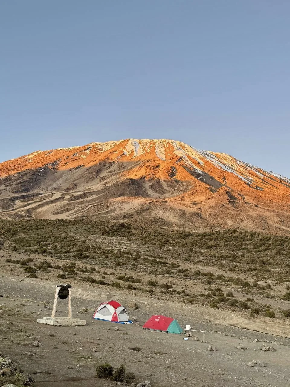
The reward is one of the most spectacular campsites on the entire mountain. Mawenzi Tarn sits at 4,300 meters in a natural amphitheatre directly below the sheer, jagged east face of Mawenzi (5,149m). The dark volcanic rock towers hundreds of meters above the small alpine lake, creating a dramatic, almost vertical backdrop that catches the light differently throughout the day. Few places on Kilimanjaro feel as wild and remote as this.
In the afternoon, your guide will lead an acclimatization hike toward Mawenzi Ridge, reaching approximately 4,500 meters before returning to camp. This “climb high, sleep low” strategy is one of the most effective ways to prepare for the summit push. Back at camp, watch the sunset turn Mawenzi’s pinnacles orange and pink against the darkening sky.
Overnight: Mawenzi Tarn — 4,300m / 14,107 ft
-
4,300m to 4,750m • 9 km • 5–6 hours • The Saddle
This is the day you cross the Saddle — the vast, 3,600-hectare high-altitude desert plateau that stretches between Kilimanjaro’s two volcanic peaks. The Saddle is the largest tropical high-altitude tundra in Africa, and walking across it is one of the defining experiences of the Rongai route — something no western route offers.
The landscape is otherworldly: barren volcanic scree in every direction, virtually no vegetation, and an immense silence broken only by wind. With Mawenzi’s jagged spires shrinking behind you and Kibo’s glaciated dome growing larger ahead, the sheer scale of Kilimanjaro becomes fully apparent. The terrain is relatively flat but the altitude makes each step deliberate. Looking left and right across this enormous plateau, you understand why early explorers compared it to walking on the moon.
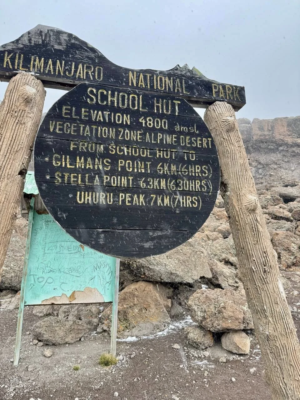
Kibo Hut sits at 4,750 meters on the eastern base of the main peak. You’ll arrive by early afternoon, eat an early dinner prepared by your cook, and try to rest before your midnight summit attempt. Your guides will brief you on what to expect during the summit push and help you prepare your gear for the early start.
Overnight: Kibo Hut — 4,750m / 15,584 ft
-
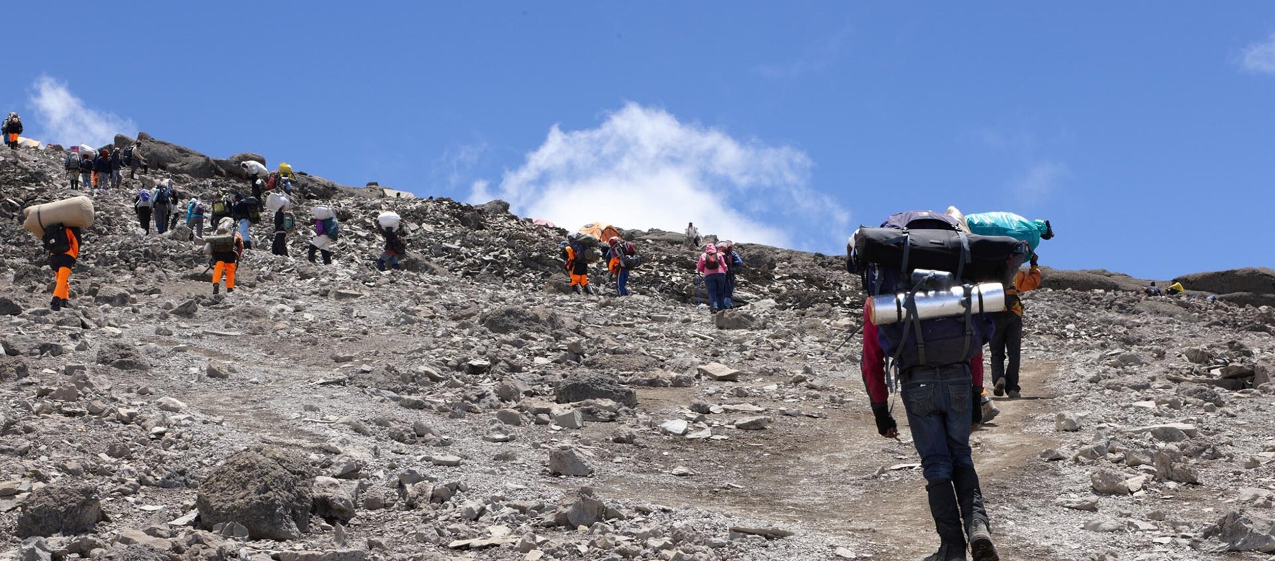
4,750m to 5,895m to 3,720m • 16 km • 12–16 hours • Arctic / Alpine Desert
You wake around midnight to hot tea and biscuits, then begin the summit push under a sky full of stars. The ascent follows a switchback trail through loose volcanic scree, climbing steadily in the darkness with headlamps illuminating the path ahead. Your guides set a slow, deliberate pace — this is where the 1:1 staff-to-climber ratio on summit night makes the biggest difference, with a dedicated guide focused entirely on your progress, breathing, and morale.
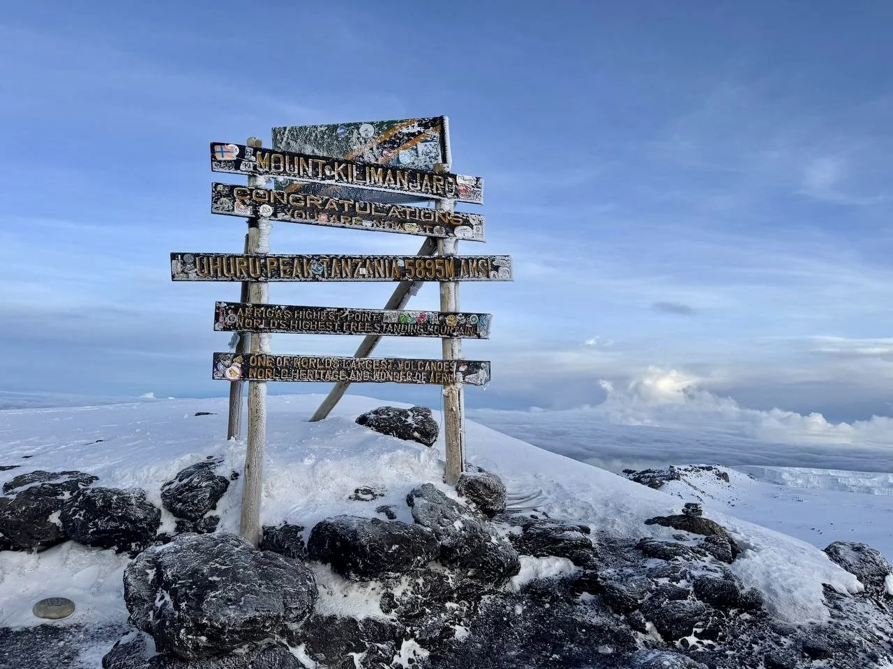
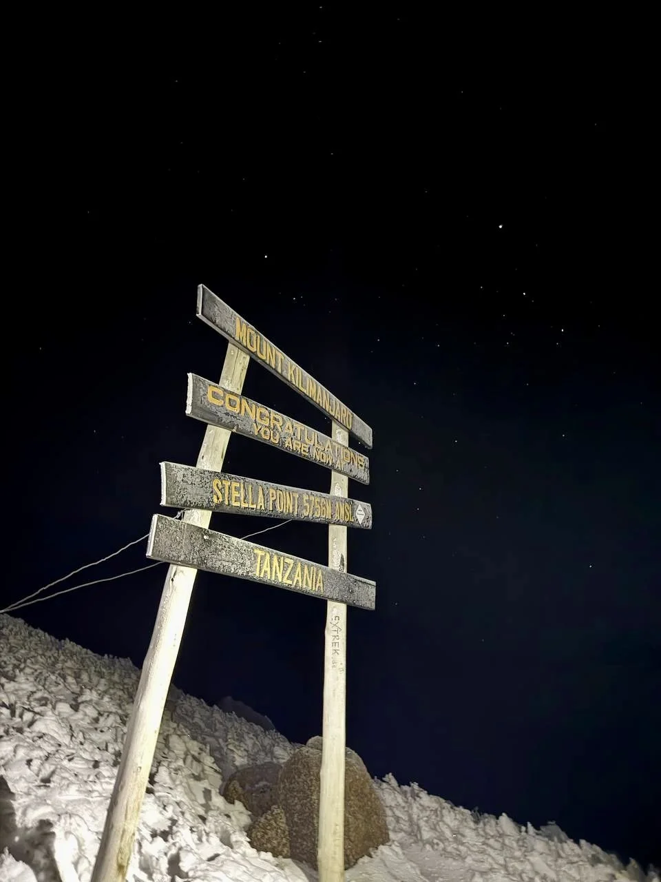
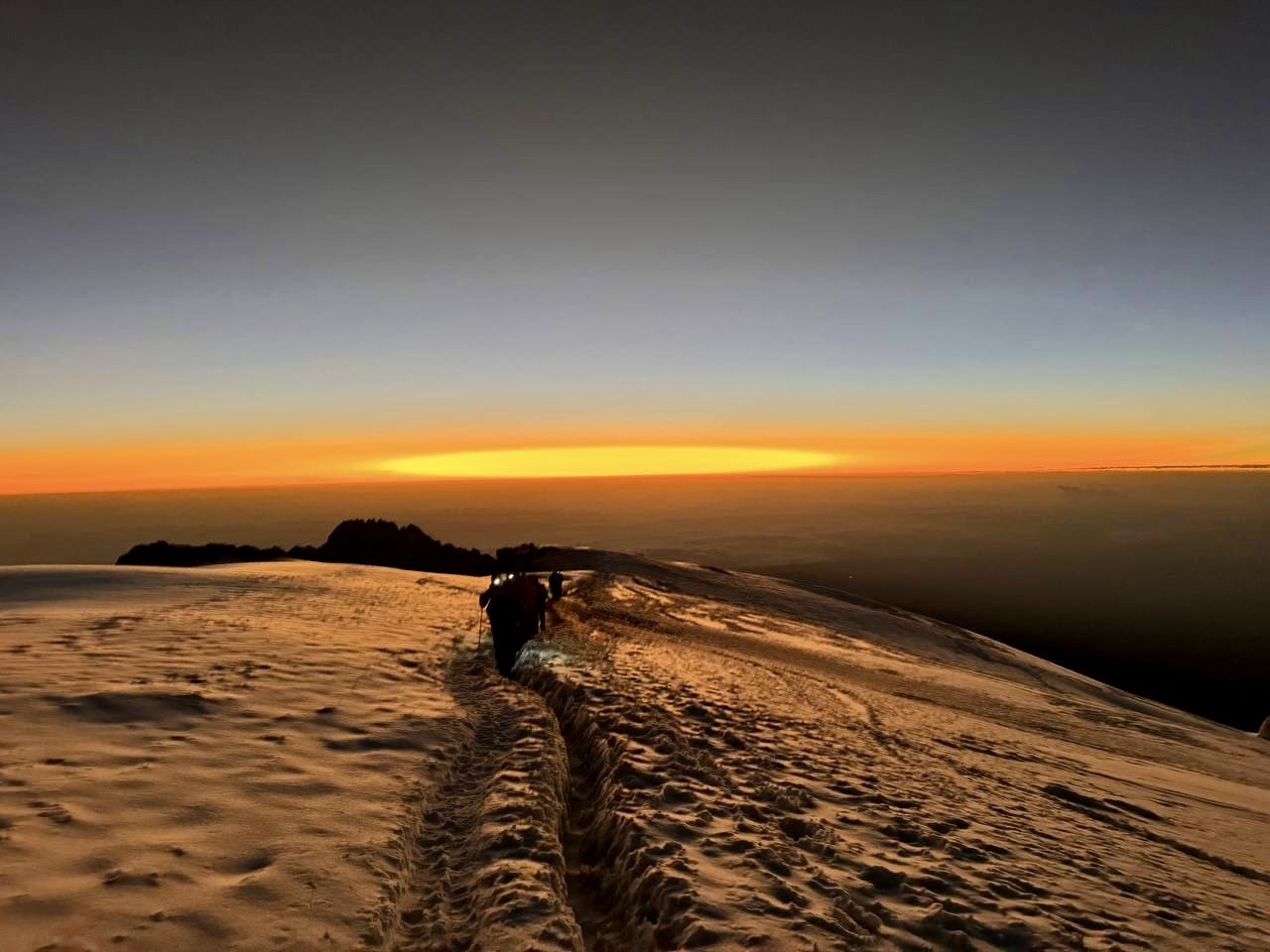
After five to six hours of climbing, you reach Gilman’s Point (5,681m) on the crater rim. The first light of dawn begins to spread across the horizon. From Gilman’s, you traverse the rim past Stella Point (5,756m), walking alongside Kilimanjaro’s shrinking glaciers, before the final push to Uhuru Peak (5,895m) — the roof of Africa. On a clear morning, the sunrise paints the glaciers gold and the shadow of Kilimanjaro stretches across the plains far below, reaching toward the Masai Steppe.
After photos and celebration at the summit sign, you descend steeply back to Kibo Hut for a rest and a meal, then continue the long walk down to Horombo Hut (3,720m) on the Marangu route. This is the longest and most demanding day of the climb, but the sense of achievement makes every step worthwhile.
Overnight: Horombo Hut — 3,720m / 12,205 ft
-
3,720m to 1,800m • 21 km • 5–7 hours • Moorland / Rainforest
The final day descends 1,920 meters from Horombo Hut through moorland and back into lush montane rainforest on the southeastern side of the mountain. This descent via the Marangu route is one of the bonuses of the Rongai approach — you see entirely different terrain on the way down than you saw on the ascent, giving you a more complete picture of Kilimanjaro’s diverse ecosystems.
The southern rainforest is a stark contrast to the drier forest you walked through on Day 1. Here, the canopy is thick and dripping, with moss-covered trees, hanging ferns, and wildflowers lining the trail. Birdsong fills the air, and the humidity returns after days of dry alpine conditions. The path is well-maintained with steps in the steeper sections, and you descend quickly through the cloud forest toward the gate.
At Marangu Gate (1,800m), you sign out of the park, collect your summit certificates, and say goodbye to your mountain crew. This is the traditional moment to hand over tips and thank the guides, porters, and cook who made your climb possible. Your vehicle will be waiting to drive you back to your hotel in Moshi or Arusha, where a hot shower and a cold drink await.
Overnight: Hotel in Moshi or Arusha
-
3,100m to 1,650m • 10 km • 3–4 hours • Rainforest
Your final morning on Kilimanjaro. After breakfast, the trail descends through the moorland and re-enters the montane rainforest. The air grows warmer and more humid with every step. After days in the stark alpine desert and arctic zone, the lush green canopy, birdsong, and the smell of damp earth feel like arriving in a different world.
The descent to Mweka Gate takes three to four hours on a well-maintained trail. At the gate, your guides and porters will be waiting to celebrate with you. This is where you receive your summit certificate — a green certificate for Uhuru Peak, gold for Stella Point. Tip your crew, buy a cold soda or souvenir, and enjoy a picnic lunch before the drive back to your hotel in Moshi.
Most climbers arrive back at their hotel by late afternoon, leaving time for a hot shower, a proper meal, and the deep satisfaction of having stood on the roof of Africa.
End: Mweka Gate — 1,650m / 5,400 ft
| Day | Highlights | Start Elevation | End Elevation | Gain / Loss | Distance | Overnight Camp | Zone |
|---|---|---|---|---|---|---|---|
| Day 1 | Drive from Moshi via Marangu to Rongai Gate; trek through cultivated farmland into montane forest; drier eastern climate with pine and heather | 1,950m | 2,600m | +650m | 8 km | Simba Camp | Rainforest |
| Day 2 | Forest to moorland transition; open heathland with views toward Kenya; giant heather and grasses | 2,600m | 3,450m | +850m | 8 km | Second Cave | Moorland |
| Day 3 | Moorland to alpine desert; views of Mawenzi’s jagged peaks; quieter trail with few other groups | 3,450m | 3,600m | +150m | 6 km | Kikelewa Camp | Moorland |
| Day 4 | Steep climb to Mawenzi Tarn; dramatic amphitheatre below Mawenzi’s east face; acclimatization hike toward Mawenzi Ridge | 3,600m | 4,300m | +700m | 5 km | Mawenzi Tarn | Alpine Desert |
| Day 5 | Cross the Saddle — 3,600-hectare high-altitude desert between Mawenzi and Kibo; lunar landscape; arrive at Kibo Hut | 4,300m | 4,750m | +450m | 9 km | Kibo Hut | The Saddle |
| Day 6 | Summit night; Gilman’s Point (5,681m); Stella Point; Uhuru Peak (5,895m) — roof of Africa; descend to Horombo Hut | 4,750m | 3,720m | +1,145m / –2,175m | 16 km | Horombo Hut | Arctic |
| Day 7 | Final descent via Marangu route through cloud forest; summit certificates at Marangu Gate; drive to hotel | 3,720m | 1,800m | –1,920m | 21 km | — | Rainforest |
Route Summary Table
Pricing, Inclusions & Exclusions
Included in Your Climb
- All Kilimanjaro National Park entrance and camping fees
- WFR-certified head guide with 7+ years of Kilimanjaro experience
- Assistant guides and porters
- Professional mountain cook
- All meals on the mountain (breakfast, lunch, dinner, and snacks)
- Filtered drinking water
- Four-season mountaineering tents
- Sleeping mats
- Private toilet tent
- Emergency oxygen cylinder and pulse oximeter
- Daily health monitoring and vitals checks
- 1:1 staff-to-climber ratio on summit night
- Round-trip hotel-to-trailhead transport (Moshi or Arusha)
- Post-climb summit certificate
Not Included
- International flights
- Tanzania visa (available on arrival, ~$50 USD)
- Travel and evacuation insurance (required)
- Personal hiking gear and clothing
- Sleeping bag (rental available)
- Trekking poles (rental available)
- Tips for guides, porters, and cook
- Pre- and post-climb hotel accommodation
- Meals in town before and after the climb
- Souvenirs and personal expenses
- Optional Diamox (altitude sickness medication)
2026 Rongai Route Pricing — Published and Transparent
All prices are per person in USD. No hidden fees or surcharges.
Contact Stacy to discuss your group size, dates, and any custom requirements.
Duma Kilimanjaro Itineraries

Machame Route Itinerary
Rongai Route Itinerary

Lemosho Shira Route Itinerary
The Northern Circuit Route Itinerary

Lemosho Shira via Crater Route Itinerary

Marangu Route Itinerary
Umbwe Route Itinerary
Frequently Asked Questions
-
The Rongai route is the only route that approaches Mount Kilimanjaro from the north, near the Kenyan border. It begins at Rongai Gate (1,950 meters) and traverses the drier eastern side of the mountain before crossing the Saddle, a vast high-altitude desert plateau between the Mawenzi and Kibo peaks. The route descends via the Marangu route on the southeastern side. Duma Explorer recommends the 7-day itinerary for optimal acclimatization and a summit success rate of approximately 85 percent.
-
The Saddle is a 3,600-hectare high-altitude desert plateau that stretches between Kilimanjaro’s two volcanic peaks, Mawenzi (5,149 meters) and Kibo (5,895 meters). Sitting at roughly 4,300 to 4,750 meters, it is the largest tropical high-altitude tundra in Africa. The landscape is barren and lunar, with loose volcanic scree and virtually no vegetation. On the Rongai route, you cross the Saddle on Day 5 as you walk from Mawenzi Tarn to Kibo Hut, with dramatic views of both peaks on either side.
-
The Rongai route differs in several important ways. It approaches from the drier eastern side of Kilimanjaro, which receives significantly less rainfall than the southern and western slopes. This makes it the best choice during the rainy season. The trail is quieter, with far fewer climbers than the popular Machame and Lemosho routes. Instead of the Barranco Wall scramble, the Rongai route features the Saddle crossing between Mawenzi and Kibo. The terrain is gentler with a more gradual ascent profile. The route descends via the Marangu route, meaning you start and finish at different gates.
-
Kilimanjaro’s eastern and northern slopes sit in a rain shadow created by the mountain’s massive bulk. Moisture-laden trade winds arrive primarily from the southeast, dropping most of their rainfall on the southern and western slopes. By the time air currents reach the northern and eastern flanks, they carry far less moisture. This produces a noticeably drier climate with sparser vegetation, more open landscapes, and less muddy trails. The drier conditions make the Rongai route particularly attractive for climbers trekking during the March to May long rains or the November short rains.
-
The 7-day Rongai route adds an extra night at Kikelewa Camp between Second Cave and Mawenzi Tarn. This additional day gives your body more time to acclimatize before the steep climb to Mawenzi Tarn and the Saddle crossing to Kibo Hut. The 7-day route has a summit success rate of approximately 85 percent, compared to roughly 65 to 70 percent for the 6-day version. Duma Explorer recommends the 7-day itinerary for most climbers.
-
The industry-wide summit success rate for the 7-day Rongai route is approximately 85 percent. The 6-day version has a lower success rate of roughly 65 to 70 percent due to less acclimatization time. Duma Explorer achieves a 97 percent success rate on the Rongai route thanks to our 1:1 staff-to-climber ratio on summit night, WFR-certified guides, and proven acclimatization protocols.
-
The Rongai route passes through four ecological zones with a distinctly different character from the western routes. The lower slopes feature cultivated farmland transitioning into drier montane forest with pine, cedar, and heather rather than the lush dripping rainforest found on the south side. Above the treeline, open moorland gives way to alpine desert. The highlight is the dramatic amphitheatre below Mawenzi’s jagged east face at Mawenzi Tarn, followed by the crossing of the Saddle, a vast lunar-like plateau between the two peaks. On clear days you can see across the border into Kenya.
-
The Rongai route can be climbed year-round and is the best route choice during the rainy seasons because its eastern approach receives significantly less rainfall. The long dry season from June through October offers the most stable weather across all routes. However, the Rongai route is an excellent option during the long rains of March through May and the short rains of November, when the western routes are at their wettest. January and February are also good months.
-
Duma Explorer’s 2026 pricing for the 7-day Rongai route starts at $2,399 per person for groups of 8 or more, $2,599 per person for groups of 4 to 7, and $2,999 per person for groups of 2 to 3. The 6-day Rongai starts at $2,099 for groups of 8 or more and goes up to $2,699 for 2 to 3 people. All prices include park fees, meals, camping equipment, WFR-certified guides, porters, emergency oxygen, and transport.
-
All Duma Explorer Rongai climbs include park entrance and camping fees, all meals on the mountain, filtered drinking water, four-season mountaineering tents, sleeping mats, a private toilet tent, a WFR-certified head guide with at least 7 years of Kilimanjaro experience, assistant guides and porters, a professional mountain cook, emergency oxygen and pulse oximeter, daily health monitoring, a 1:1 staff-to-climber ratio on summit night, round-trip hotel-to-trailhead transport, and a post-climb summit certificate.
-
The Rongai route is a well-established, non-technical trail with a gentle ascent profile. Duma Explorer prioritizes safety: our WFR-certified guides monitor your vitals daily with pulse oximeters, carry emergency oxygen on every climb, and maintain a 1:1 staff-to-climber ratio on summit night. If a serious medical emergency occurs, helicopter evacuation is available through KiliMedAir, the authorized aerial rescue provider on Kilimanjaro. Designated helicopter landing zones exist at key points along the route. We strongly recommend purchasing travel insurance that explicitly covers high-altitude trekking and helicopter evacuation. Read our complete guide: Helicopter Evacuation on Kilimanjaro
Your Rongai Climb Starts here
Tell Stacy your dates, fitness level, and goals — she’ll match you with the right itinerary, build your crew, and handle every detail from trailhead to summit.