Machame Route Kilimanjaro
Kilimanjaro’s Most Popular Camping Route
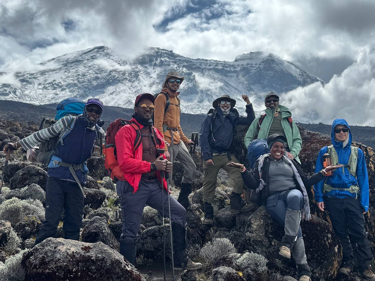
The Machame route — nicknamed the “Whiskey Route” for its reputation as a tougher alternative to the “Coca-Cola” Marangu trail — is the most popular camping route on Mount Kilimanjaro. It approaches from the south, beginning in dense montane rainforest near the village of Machame before climbing through heather moorland, across the alpine desert, and up to the glaciated summit at 5,895 meters.
With an industry-wide summit success rate of approximately 85–90% on the 7-day itinerary, the Machame route offers strong acclimatization, dramatic scenery, and the famous Barranco Wall scramble. Duma Explorer recommends the 7-day Machame for climbers who want a well-rounded Kilimanjaro experience at a lower price point than the Lemosho route. The extra day (compared to the 6-day version) adds a night at Karanga Camp for better altitude adjustment before the summit push.
Duration: 7 Days / 6 Nights (recommended) or 6 Days / 5 Nights
Distance: ~62 km (37 miles)
Summit Elevation: 5,895m / 19,341 ft
Success Rate: ~85–90% on 7-day (industry average)
Difficulty: Moderate to challenging (non-technical)
Best Months: June – October, January – February
Starting Price: From $2,099 per person
Max Group Size: 8 climbers
IN THIS GUIDE
Machame Route | Day-by-Day Itinerary | Route Summary | Pricing | Photos | Kilimanjaro Itineraries | FAQ | Resources
Four Worlds in Eight Days
Kilimanjaro’s Ecological Zones on the Machame Route
Montane Rainforest (1,800–2,800m)
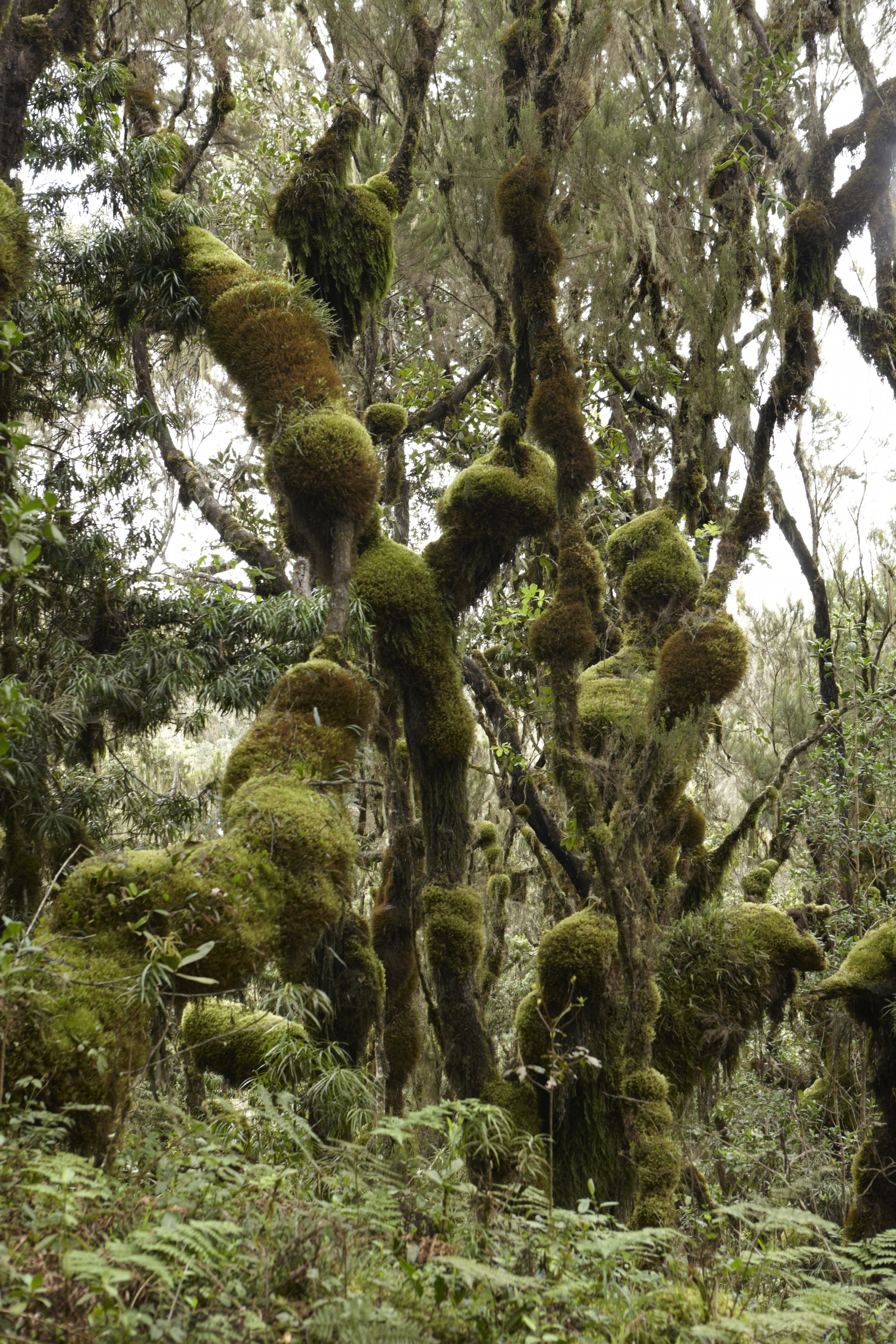
Your climb begins in a lush, dripping rainforest. Towering camphorwood and podocarpus trees form a dense canopy overhead, their branches draped in old man’s beard moss and laced with ferns. The trail follows a well-worn path through thick undergrowth, crossing small streams and passing stands of giant tree ferns. Black-and-white colobus monkeys swing through the canopy, and blue monkeys forage in the lower branches. Birdsong fills the air — Hartlaub’s turacos flash crimson wing feathers as they take flight. The humidity is high and rain is possible any day, but the forest canopy keeps the trail cool and sheltered.
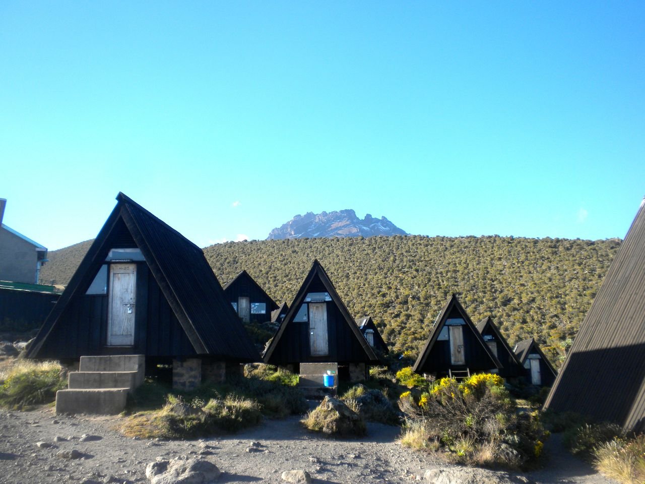
Heath and Moorland (2,800–4,000m)
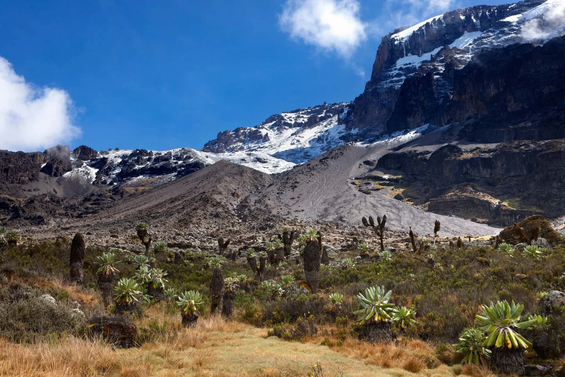
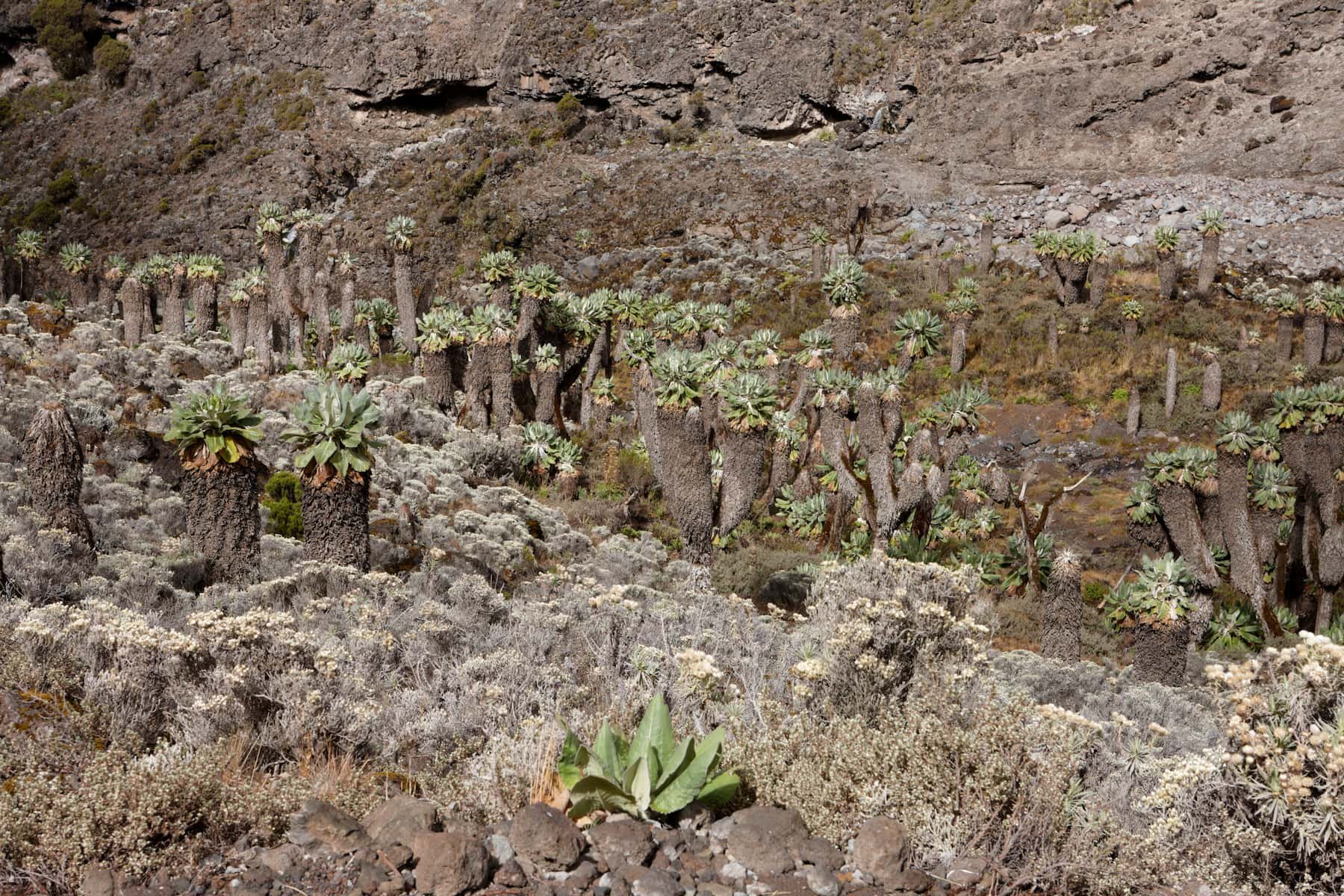
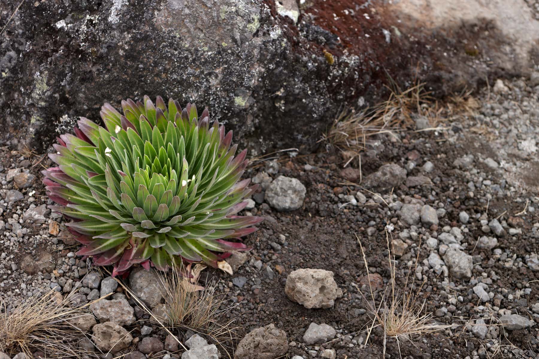
As you climb above the treeline, the forest thins into rolling moorland. Giant heather trees, some reaching 10 meters tall, line the trail alongside tussock grasses and wildflowers. The iconic Kilimanjaro plants begin to appear — giant groundsels (Dendrosenecio kilimanjari) and giant lobelias (Lobelia deckenii), prehistoric-looking species found only at high altitude in East Africa. On clear days, the views are expansive: the Shira Plateau stretching to the west, Mount Meru rising to the east, and the glaciated dome of Kibo ahead. Nights grow cold as you gain altitude, and morning frost is common on the tents.
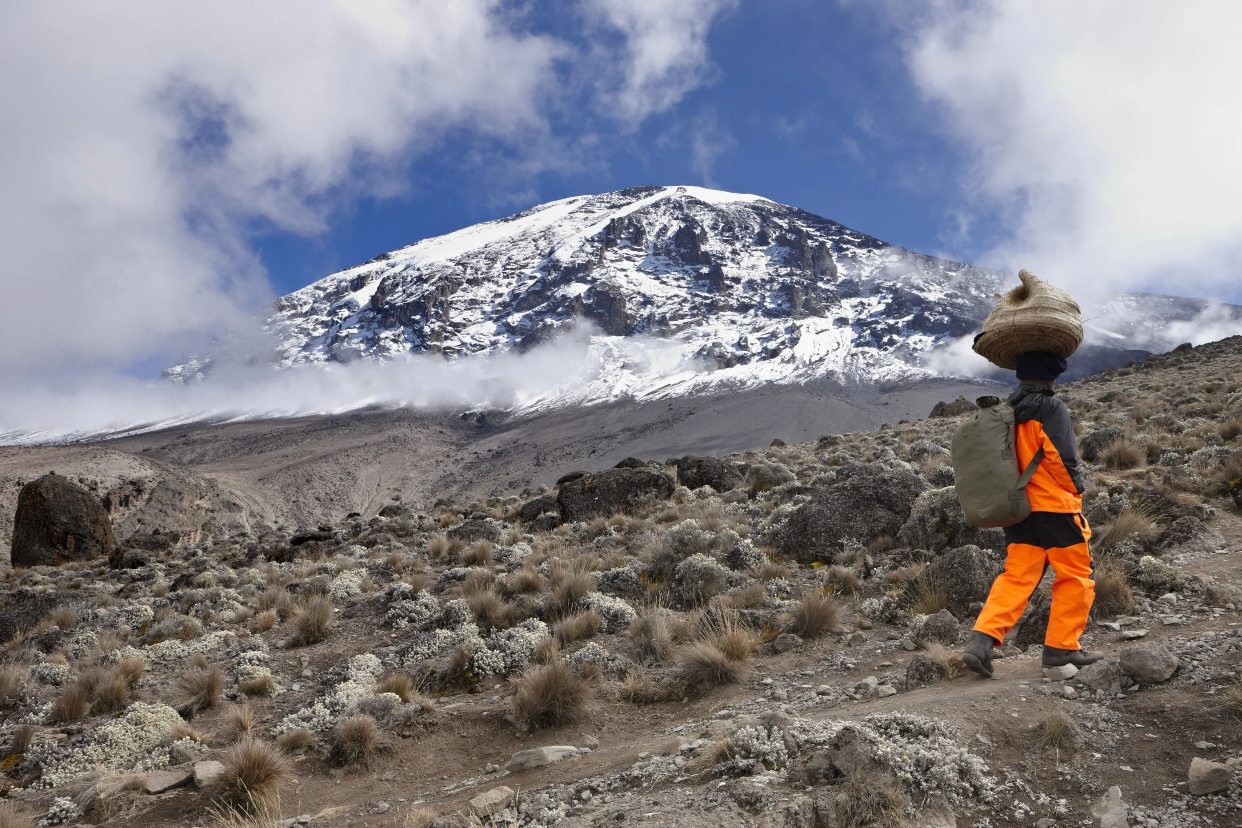
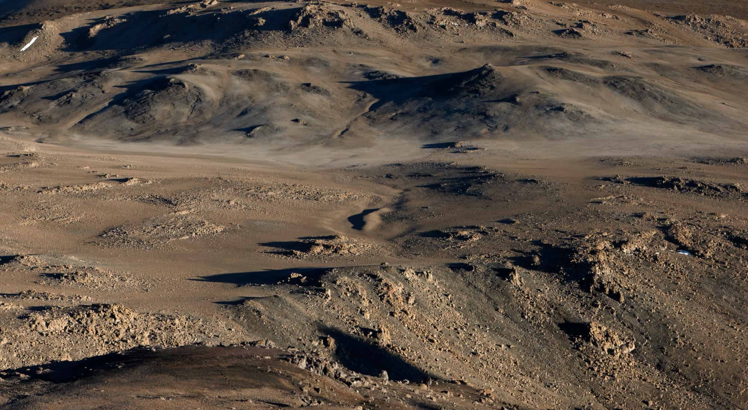
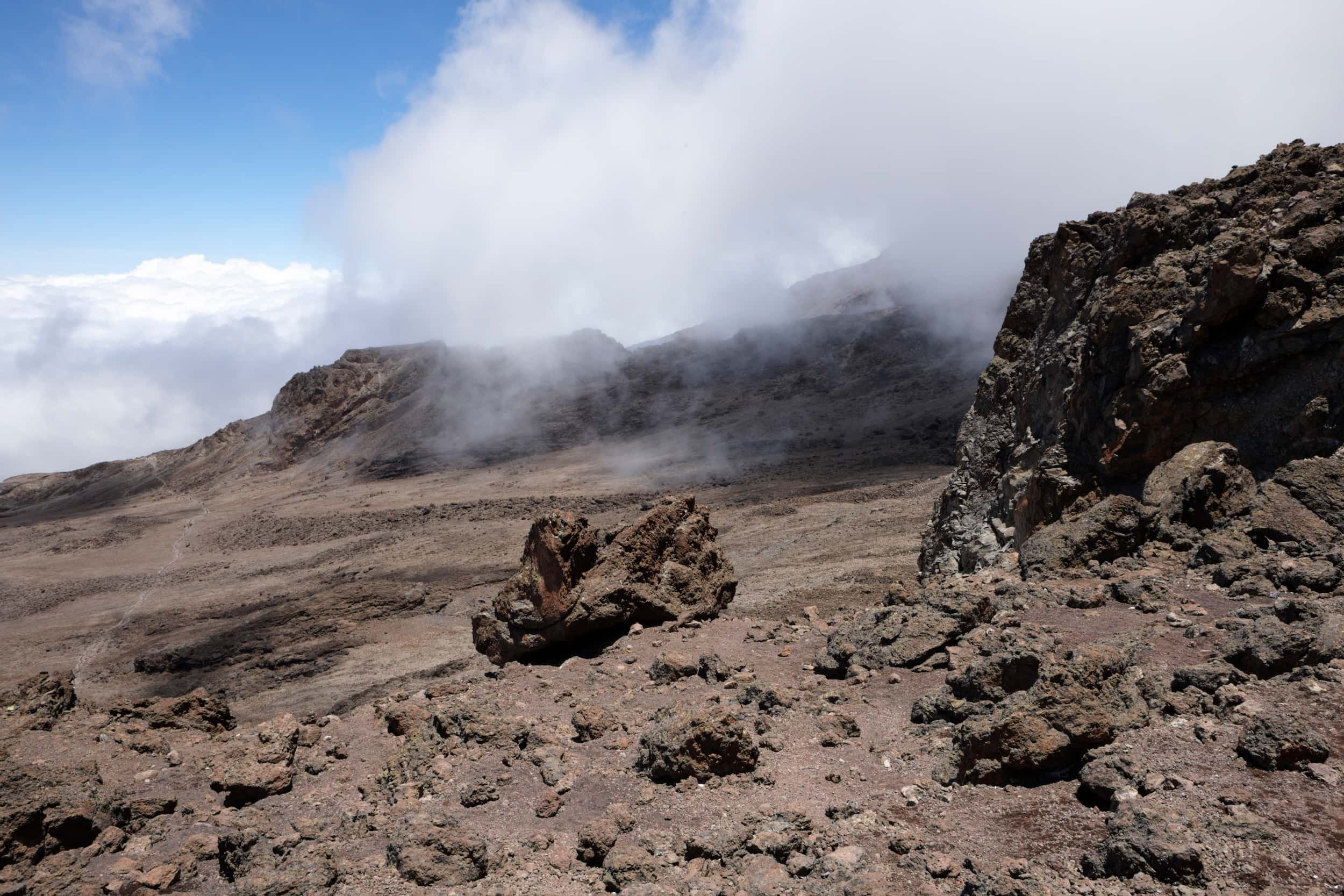
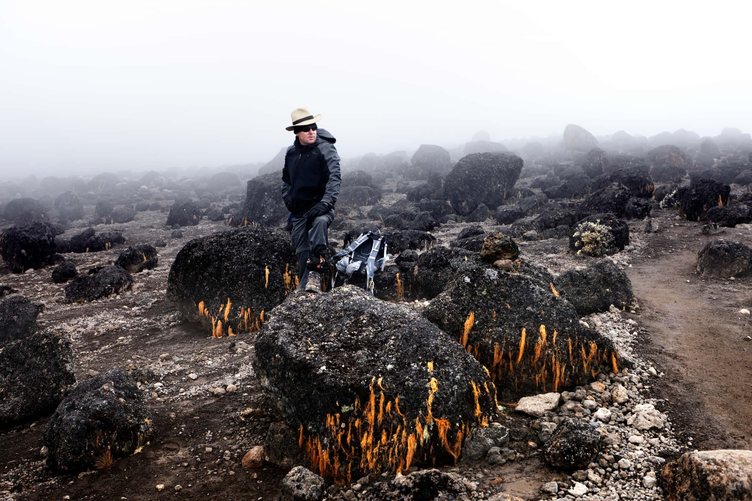
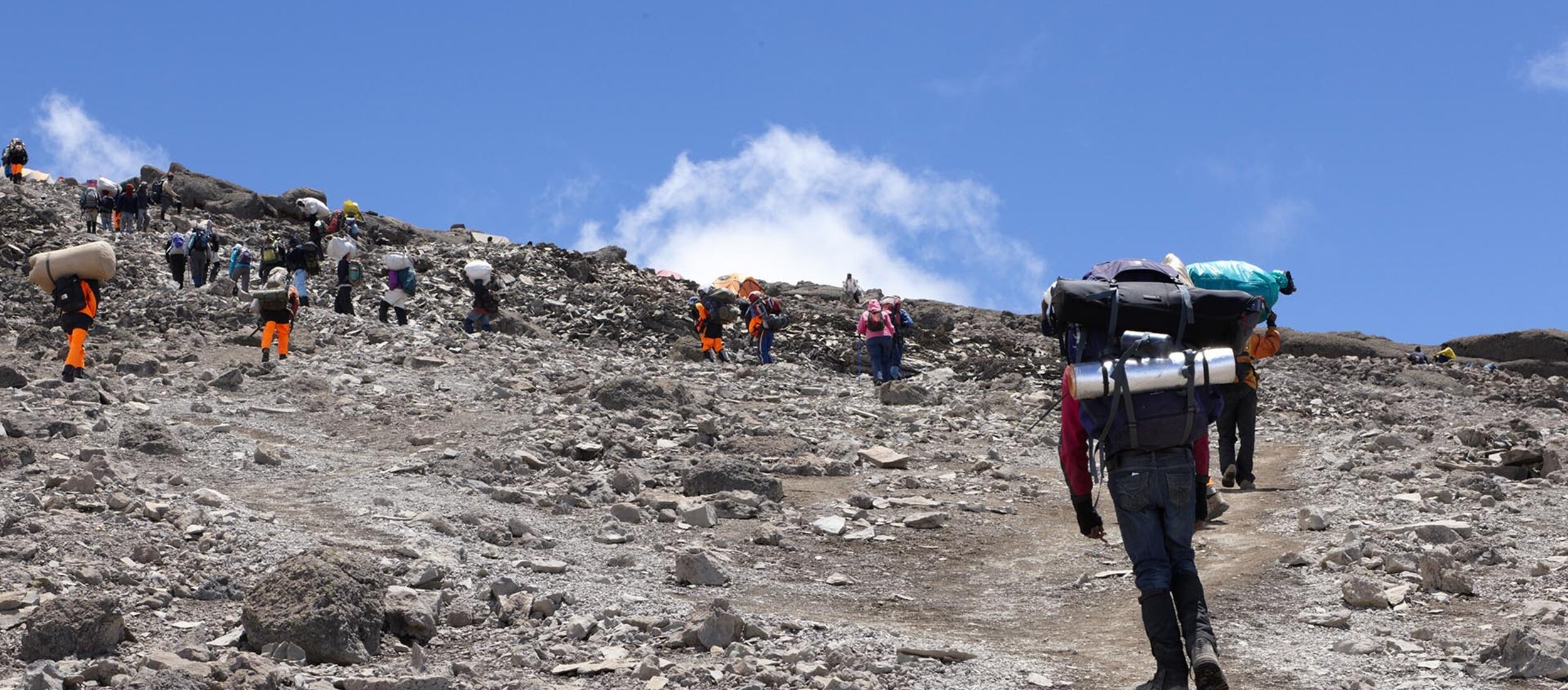
Alpine Desert (4,000–5,000m)
Above 4,000 meters, vegetation all but disappears. The landscape becomes stark and otherworldly — volcanic scree, exposed rock, and thin air under an enormous sky. Temperatures swing from near-freezing at night to intense equatorial sun during the day. Hardy everlasting flowers (Helichrysum) cling to crevices in the rock. This is where the Barranco Wall rises 257 meters above camp — the most memorable scramble on any Kilimanjaro route. From the ridgelines, you can see the Heim, Kersten, and Decken glaciers clinging to Kibo’s southern face.
Arctic / Summit Zone (5,000m+)
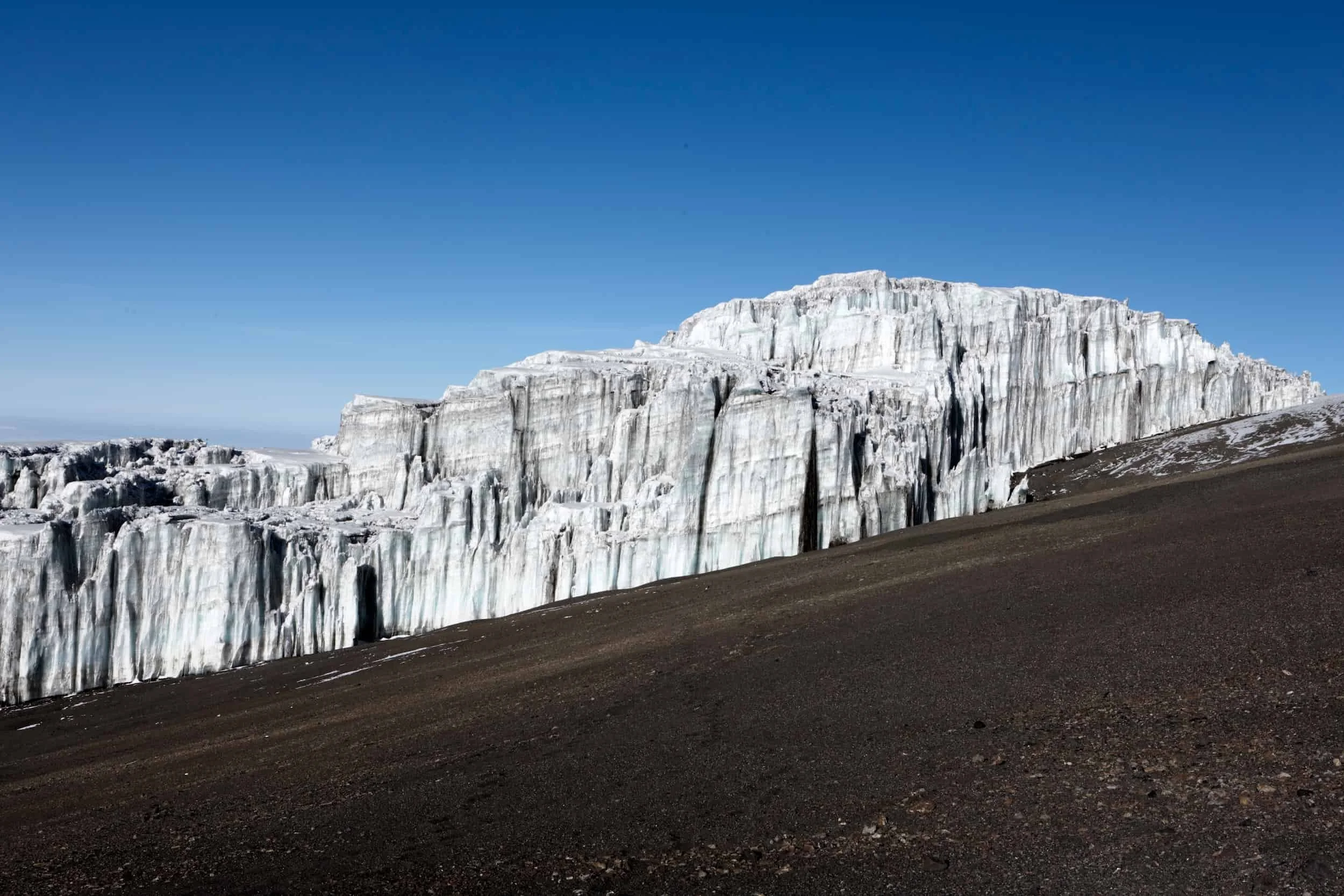
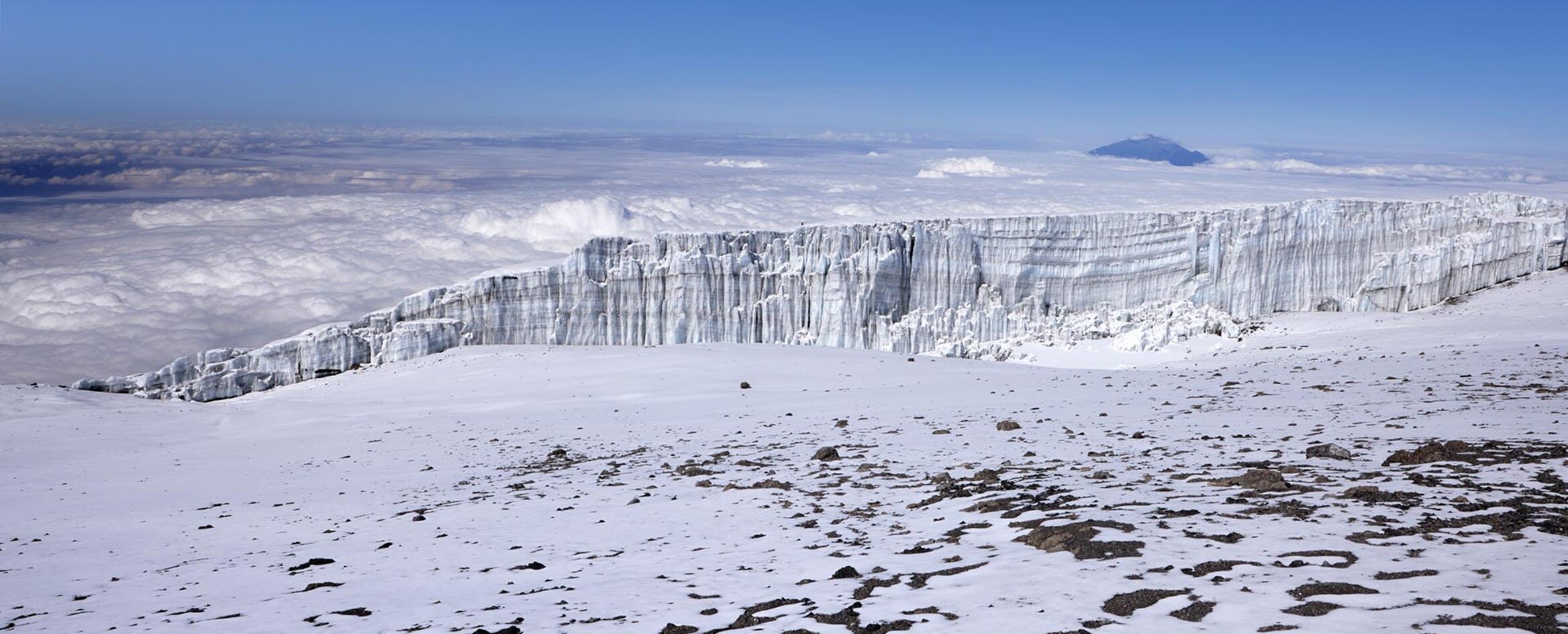
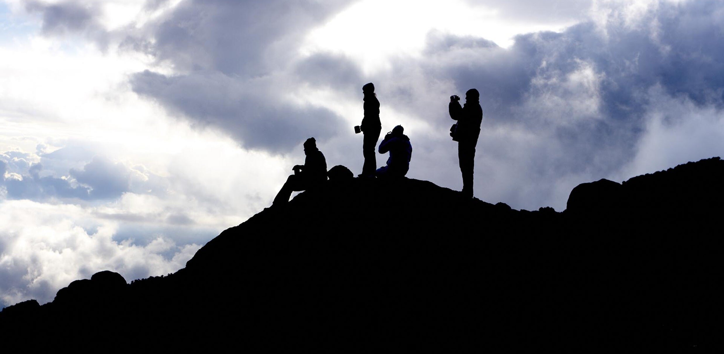
Summit night takes you into Kilimanjaro’s arctic zone — a lunar landscape of rock, ice, and thin air. You climb through the darkness by headlamp, switchbacking up steep scree toward Stella Point on the crater rim. At sunrise, the glaciers glow orange and pink. The final walk along the crater rim to Uhuru Peak is a gradual, breathtaking traverse past the Furtwangler Glacier and the Northern Icefield. At 5,895 meters, you stand on the roof of Africa.
Machame Day-by-Day Itinerary
Each day on the 7-day Machame route is designed with purpose. The first two days build your acclimatization gradually through the rainforest and moorland. Day 3 is the critical “climb high, sleep low” day at Lava Tower. Day 4 delivers the famous Barranco Wall scramble. Day 5 is a rest-and-acclimatize day at Karanga before the push to high camp. Summit night and the descent follow on Days 6 and 7.
-
1,800m to 3,010m • 11 km • 5–6 hours • Montane Rainforest
Your Kilimanjaro climb begins with a morning departure from your hotel in Moshi or Arusha. The drive to Machame Gate takes roughly 45 minutes from Moshi or two hours from Arusha, passing through coffee plantations and the village of Machame — one of the most densely settled areas on the mountain’s lower slopes.
At the gate (1,800m), your guides register the climb while porters organize gear. Once formalities are complete, you step into Kilimanjaro’s montane rainforest — a dense, cathedral-like canopy of camphorwood, podocarpus, and fig trees. The trail is well-maintained but can be muddy after rain. Moss and ferns drape the branches overhead, and the air is thick with humidity and birdsong. Look up for black-and-white colobus monkeys in the canopy and Hartlaub’s turacos flashing crimson wings.
The trail climbs steadily through the forest, crossing several small streams. As you gain altitude, the trees thin and you begin to see heathers and tall grasses at the forest’s upper edge. If the weather is clear, you catch your first glimpse of Kibo peak through the canopy — a powerful reminder of what lies ahead.
Overnight: Machame Camp — 3,010m / 9,875 ft -
3,010m to 3,900m • 5 km • 4–6 hours • Rainforest to Heath/Moorland
Today the landscape transforms as you leave the rainforest behind and climb into Kilimanjaro’s heath and moorland zone. The trail is steep in places, with several rocky sections that require steady footing. Carry plenty of water — it can be surprisingly hot hiking in direct sun on a clear day.
As you gain altitude, the trees shrink and give way to giant heather, tussock grasses, and the first giant groundsels (Dendrosenecio kilimanjari) and lobelias (Lobelia deckenii) — prehistoric-looking plants found only at high altitude in East Africa. Several viewpoints along the trail offer expansive views of the plains below and the commanding peaks of Kibo and Mawenzi above.
The trail flattens as you approach the Shira Plateau, a vast ancient caldera formed when one of Kilimanjaro’s three volcanic cones collapsed. Shira Camp sits on the western edge of this plateau at 3,900 meters, with Kibo rising to the east and Mount Meru visible to the southeast on clear days.
Overnight: Shira Camp — 3,900m / 12,795 ft
-
3,900m to 4,600m to 3,960m • 10 km • 6–8 hours • Moorland / Alpine Desert
Today is the most important acclimatization day of the climb. The principle is simple: climb high, sleep low. You ascend nearly 700 meters to Lava Tower at 4,600 meters before descending 650 meters to Barranco Camp. This deliberate altitude exposure and descent is critical for summit success.
The morning trail crosses the Shira Plateau heading east. You pass the junction where the Lemosho route merges with the Machame trail, then enter the alpine desert — a stark, barren landscape of volcanic rock and thin air. Lava Tower is a dramatic 90-meter volcanic plug jutting from the mountainside, a remnant of Kilimanjaro’s earlier eruptions. Many climbers feel the altitude here for the first time — a slight headache, shortness of breath, or fatigue. This is normal and exactly why this day matters.
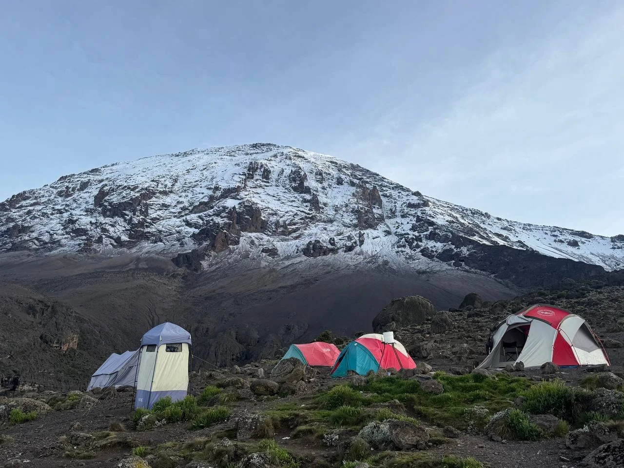
The descent from Lava Tower to Barranco Camp drops through a valley of giant groundsels (Senecio kilimanjari), some growing over five meters tall. Barranco Camp is widely regarded as the most beautiful campsite on Kilimanjaro. It sits in a natural amphitheater at the base of the Barranco Wall, with the glaciated southern face of Kibo towering overhead and the Breach Wall directly above.
Overnight: Barranco Camp — 3,960m / 12,992 ft
-
3,960m to 3,960m • 5 km • 4–5 hours • Alpine Desert
The day begins with the climb everyone has been talking about: the Barranco Wall. Rising 257 meters above camp, the wall is a non-technical scramble that looks far more intimidating than it is. Your guides know every handhold. You use your hands in places, but no ropes or climbing equipment are needed. The views from the top are spectacular — looking back over Barranco Camp and out across the clouds below.
The ascent takes roughly an hour of steady scrambling, with a few sections where you use your hands for balance. Once on top, the trail traverses a series of ridges and valleys with views of the Heim and Kersten glaciers on Kibo’s southern face. A short, steep descent brings you into the Karanga Valley before a final climb to camp.
Karanga Camp is the last water point before the summit. This extra night (which the 6-day itinerary skips) gives your body one more day to acclimatize before the demanding push to Barafu and then to the summit. It is the single biggest reason the 7-day Machame has a significantly higher success rate than the 6-day version.
Overnight: Karanga Camp — 3,960m / 12,992 ft
-
3,960m to 4,640m • 4 km • 4–5 hours • Alpine Desert
Today you climb to Barafu Camp, your base for the summit attempt. The trail ascends steadily through barren alpine desert, with increasingly dramatic views of the Rebmann, Kersten, and Decken glaciers on Kibo’s southern flank.
Along the way, you pass the junction where the Mweka descent route branches off — you will return this way after summit night. The landscape is stark: volcanic rock, scattered boulders, and virtually no vegetation. The air is noticeably thinner.
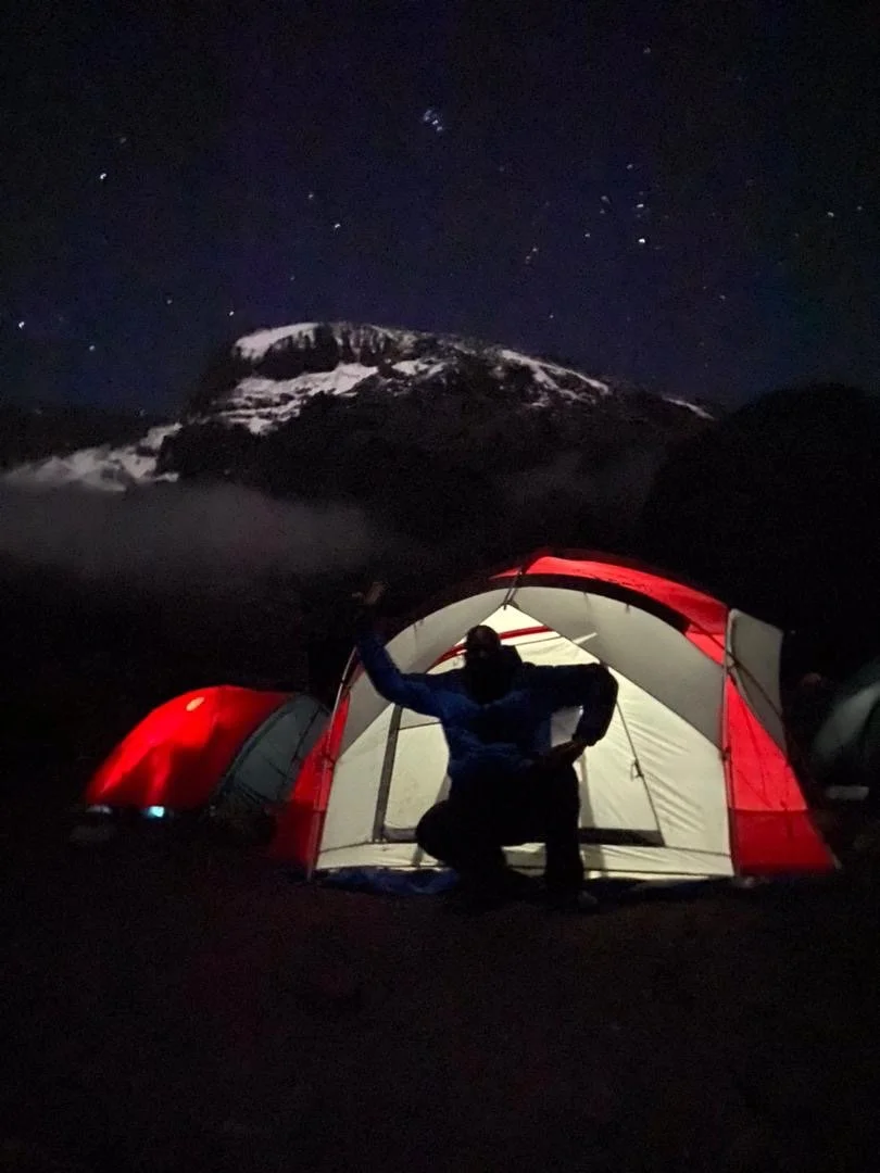
Barafu Camp sits on an exposed, rocky ridge at 4,640 meters. The name means “ice” in Swahili — fitting, as nighttime temperatures drop well below freezing. Your guides will brief you on the summit night plan: wake-up time, what to wear, what to carry. Eat dinner early and try to sleep by 7 pm. You will be woken before midnight.
Overnight: Barafu Camp — 4,640m / 15,223 ft
-
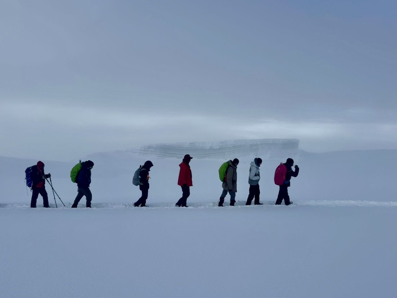
4,640m to 5,895m to 3,100m • 17 km • 12–15 hours • Arctic / Alpine Desert / Moorland
You wake around 11:30 pm to hot tea and biscuits. By midnight, you are moving. Headlamp on, warm layers tight, trekking poles in hand. Duma Explorer assigns a 1:1 guide-to-climber ratio on summit night — your personal guide stays with you the entire ascent, monitoring your pace and condition.
The trail zigzags up steep scree slopes in the darkness. This is the most physically demanding stretch of the entire climb — roughly six to seven hours of uphill in thin air and sub-zero temperatures. Chemical hand and toe warmers, a thermos of hot tea, and energy gels are essential. Your guide will encourage a slow, rhythmic pace: pole pole (slowly, slowly in Swahili).
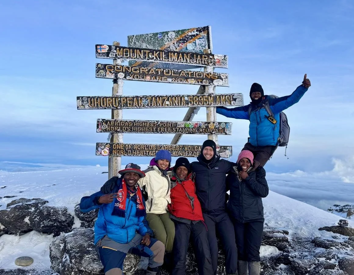
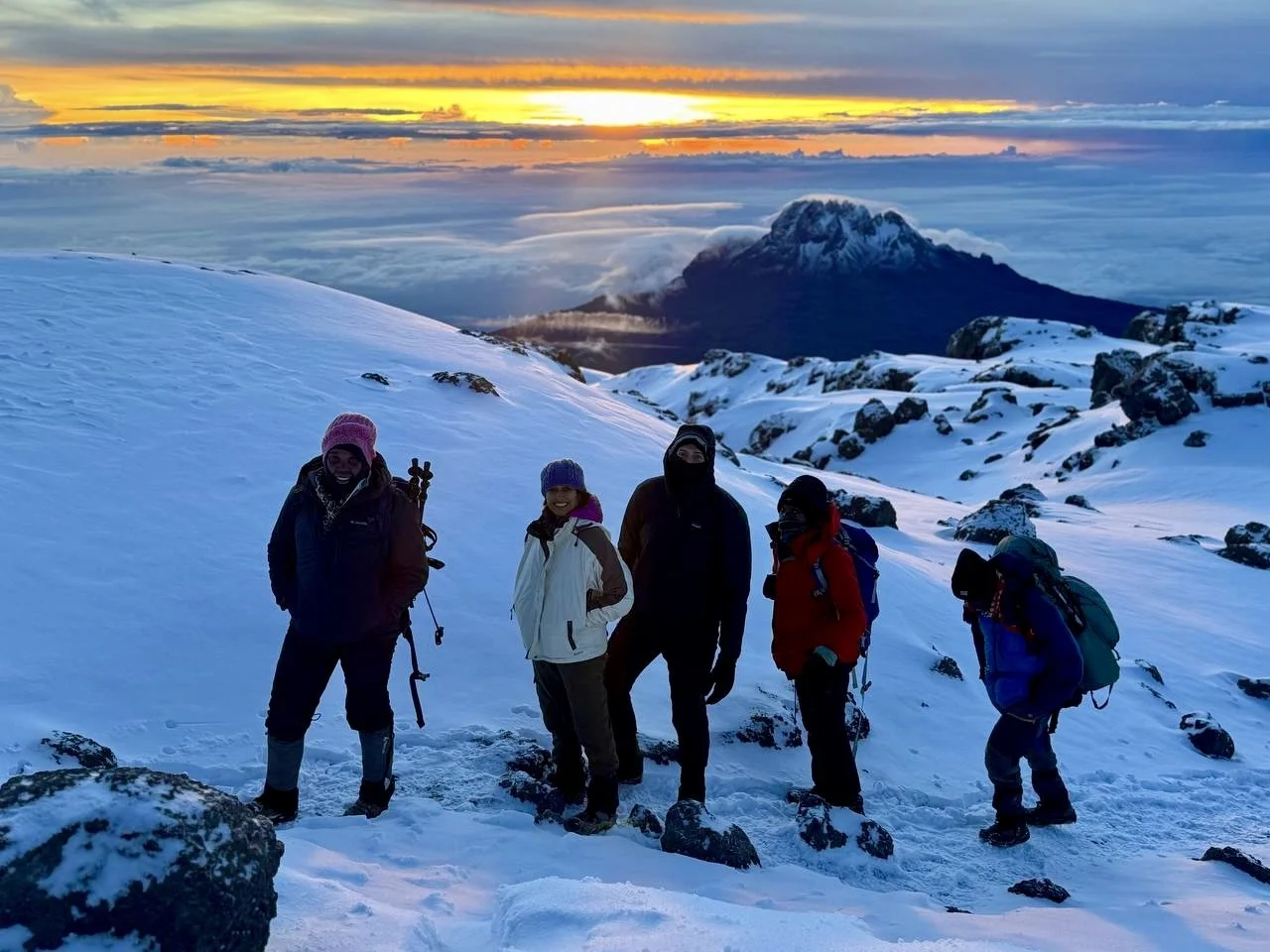
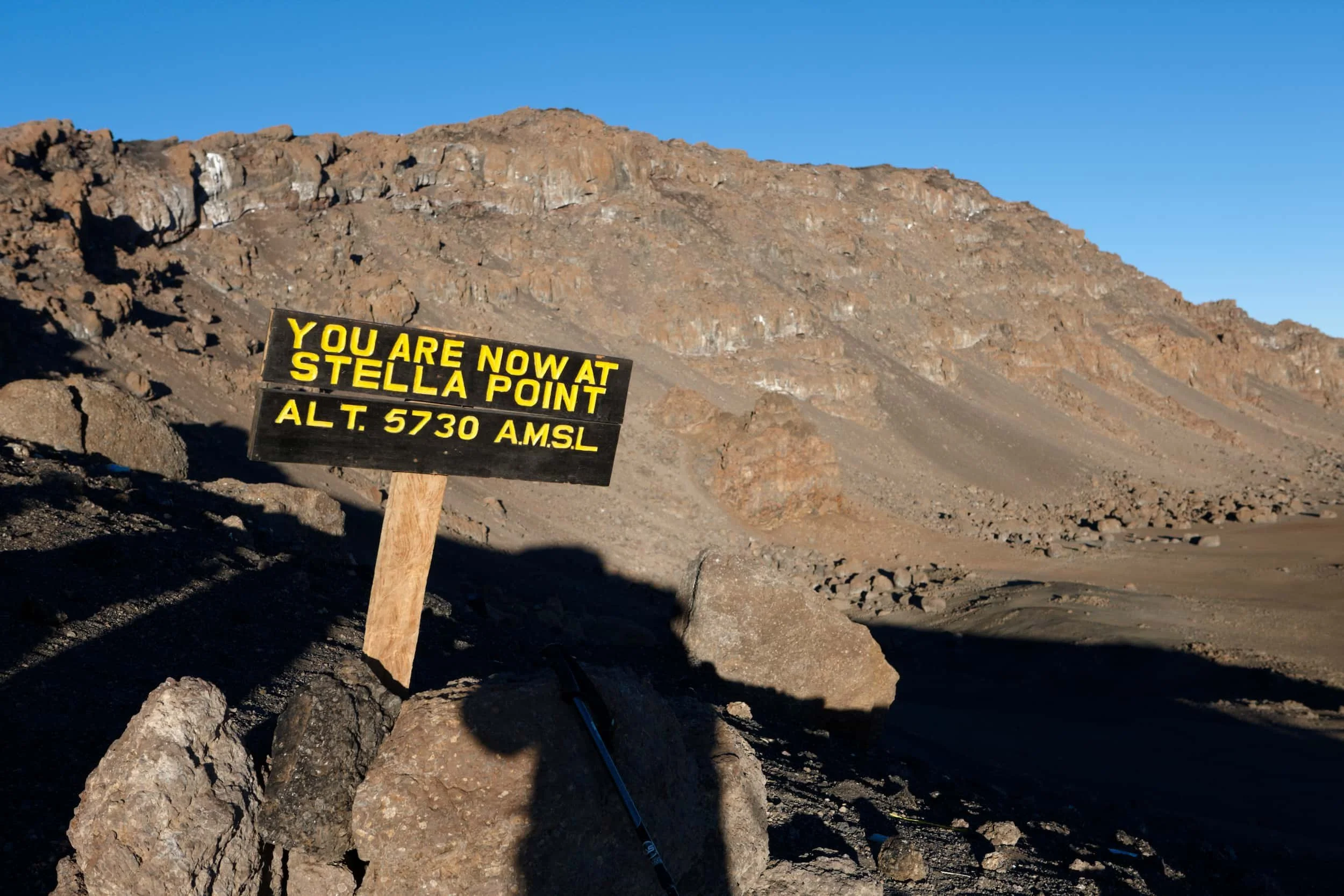
Around sunrise, you reach Stella Point at 5,752 meters on the crater rim. The reward is immediate: the sun breaks over Mawenzi peak, lighting up the glaciers and casting long shadows across the crater floor. From Stella Point, a gradual 45-minute walk along the crater rim brings you to Uhuru Peak (5,895m) — the roof of Africa. The Furtwangler Glacier and Northern Icefield stretch before you.
The descent is long but fueled by adrenaline. You return to Barafu Camp for brunch and a rest, then continue down through the alpine desert and moorland to Mweka Camp at 3,100 meters. The temperature rises with every step, and by camp the air feels thick and warm.
Overnight: Mweka Camp — 3,100m / 10,170 ft
-
3,100m to 1,640m • 10 km • 3–4 hours • Rainforest
Your final morning on Kilimanjaro. After breakfast, the trail descends through the moorland and re-enters the montane rainforest. After days in the dry alpine zones, the forest feels lush, green, and alive. The air is humid and filled with birdsong.
The descent to Mweka Gate takes three to four hours on a well-maintained trail that can be slippery after rain. At the gate, your guides present you with your official Kilimanjaro summit certificate — a gold certificate for Uhuru Peak (5,895m) or a green certificate for Stella Point (5,752m). This is also where you say goodbye to the mountain crew who made your climb possible.
Most climbers arrive back at their hotel by early afternoon, leaving time for a hot shower, a proper meal, and the first comfortable bed in a week. Many climbers continue to a safari in the Serengeti, Ngorongoro Crater, or Tarangire, or head to Zanzibar for beach time.
End: Mweka Gate — 1,640m / 5,380 ft
| Day | Highlights | Start Elevation | End Elevation | Gain / Loss | Distance | Overnight Camp | Zone |
|---|---|---|---|---|---|---|---|
| Day 1 | Drive to Machame Gate; trek through montane rainforest; colobus monkeys, moss-draped trees | 1,800m | 3,010m | +1,210m | 11 km | Machame Camp | Rainforest |
| Day 2 | Forest to moorland transition; giant heather, groundsels; first views of Kibo and Meru | 3,010m | 3,900m | +890m | 5 km | Shira Camp | Moorland |
| Day 3 | Key acclimatization day; Lava Tower (4,600m); giant groundsels; Barranco Valley descent | 3,900m | 3,960m | +700m / –640m | 10 km | Barranco Camp | Alpine Desert |
| Day 4 | Barranco Wall scramble (257m); ridge-top glacier views; Karanga Valley | 3,960m | 3,960m | +300m / –300m | 5 km | Karanga Camp | Alpine Desert |
| Day 5 | Ascent to high camp; Rebmann, Kersten & Decken glacier views; Mweka junction | 3,960m | 4,640m | +680m | 4 km | Barafu Camp | Alpine Desert |
| Day 6 | Summit night; Stella Point sunrise; Uhuru Peak (5,895m) — roof of Africa; descent to Mweka | 4,640m | 3,100m | +1,255m / –2,795m | 17 km | Mweka Camp | Arctic |
| Day 7 | Final descent through cloud forest; summit certificates at Mweka Gate; drive to hotel | 3,100m | 1,640m | –1,460m | 10 km | — | Rainforest |
Route Summary Table
Pricing, Inclusions & Exclusions
Included in Your Climb
- All Kilimanjaro National Park entrance and camping fees
- WFR-certified head guide with 7+ years of Kilimanjaro experience
- Assistant guides and porters
- Professional mountain cook
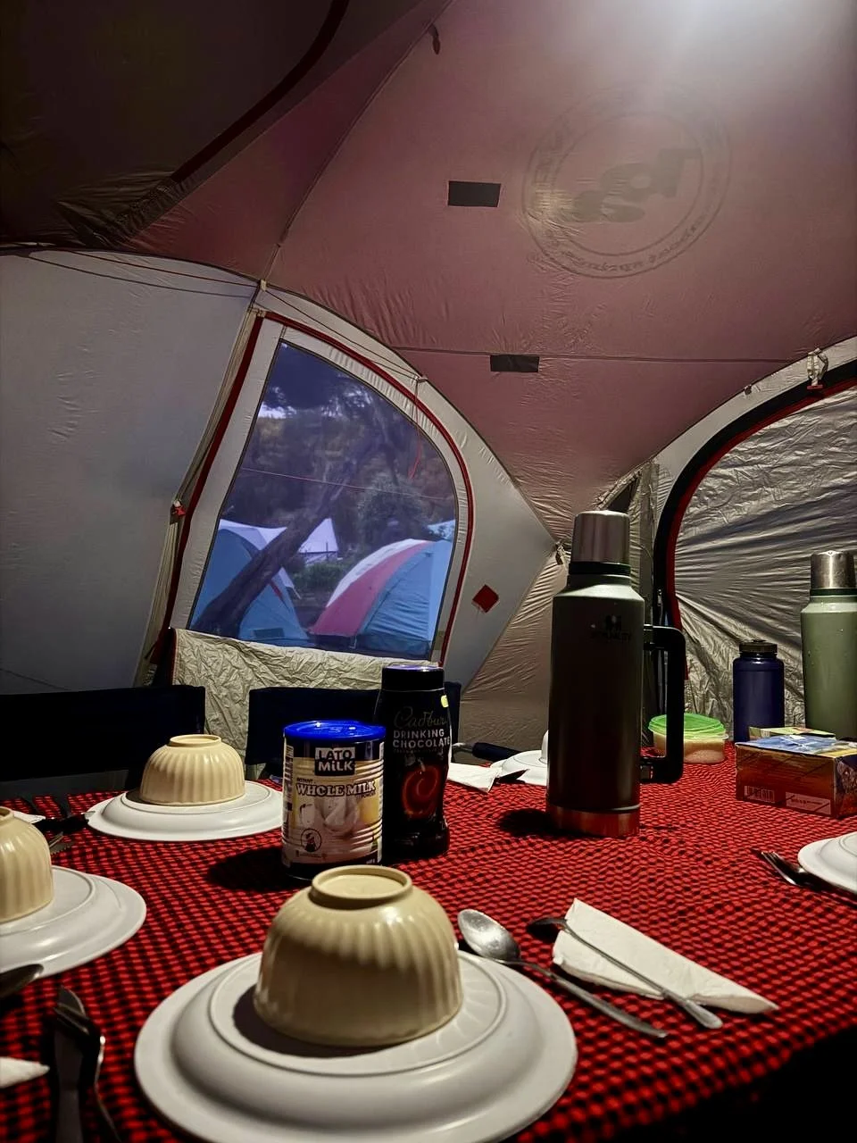
- All meals on the mountain (breakfast, lunch, dinner, and snacks)
- Filtered drinking water
- Four-season mountaineering tents
- Sleeping mats
- Private toilet tent
- Emergency oxygen cylinder and pulse oximeter
- Daily health monitoring and vitals checks
- 1:1 staff-to-climber ratio on summit night
- Round-trip hotel-to-trailhead transport (Moshi or Arusha)
- Post-climb summit certificate
Not Included
- International flights
- Tanzania visa (available on arrival, ~$50 USD)
- Travel and evacuation insurance (required)
- Personal hiking gear and clothing
- Sleeping bag (rental available)
- Trekking poles (rental available)
- Tips for guides, porters, and cook
- Pre- and post-climb hotel accommodation
- Meals in town before and after the climb
- Souvenirs and personal expenses
- Optional Diamox (altitude sickness medication)
2026 Machame Route Pricing — Published and Transparent
All prices are per person in USD. No hidden fees or surcharges.
Contact Stacy to discuss your group size, dates, and any custom requirements.
Explore Machame Route Photos

Kilimanjaro Climbing Itineraries

Marangu Route Itinerary
The Northern Circuit Route Itinerary

Machame Route Itinerary
Rongai Route Itinerary

Lemosho Shira via Crater Route Itinerary

Lemosho Shira Route Itinerary
Umbwe Route Itinerary
Frequently Asked Questions
-
The Machame route, nicknamed the Whiskey Route, is the most popular camping route on Mount Kilimanjaro. It approaches from the south, beginning at Machame Gate (1,800 meters) and passing through montane rainforest, heath moorland, alpine desert, and the arctic summit zone. The 7-day itinerary includes the famous Barranco Wall scramble and offers a summit success rate of approximately 85–90%. Duma Explorer recommends the 7-day version for better acclimatization.
-
The 7-day Machame adds an extra night at Karanga Camp between Barranco Camp and Barafu Camp (high camp). This additional day splits a long, demanding section into two shorter days and gives your body one more night to acclimatize before the summit push. The 7-day route has a summit success rate of approximately 85–90%, compared to roughly 73–75% for the 6-day version. Duma Explorer recommends the 7-day itinerary for most climbers.
-
The industry-wide summit success rate for the 7-day Machame route is approximately 85–90%. The 6-day version has a lower success rate of roughly 73–75% due to less acclimatization time. Duma Explorer achieves a 90% success rate on the Machame route thanks to our 1:1 staff-to-climber ratio on summit night, WFR-certified guides, and proven acclimatization protocols.
-
The Barranco Wall is not dangerous when climbed with experienced guides. It is a 257-meter non-technical scramble where you may use your hands for balance in a few places, but no ropes or climbing equipment are needed. Duma Explorer’s guides know every handhold and climb the wall regularly. The ascent takes roughly one hour, and the views from the top are among the best on the entire mountain.
-
The Machame route is rated moderate to challenging. It is not a technical climb — no ropes, harnesses, or mountaineering experience are required. The main challenges are altitude sickness, the long first day (11 km through rainforest), and the Barranco Wall scramble on Day 4. Summit night is the most physically demanding stretch. Duma Explorer recommends starting a training program at least two to three months before your climb, focusing on cardiovascular fitness and hiking with a loaded daypack.
-
The Machame route earned the nickname “Whiskey Route” because of its reputation as a more challenging climb compared to the Marangu route, which is known as the “Coca-Cola Route.” The terminology reflects traditional mountaineering culture where tougher routes were associated with stronger spirits and easier routes with soft drinks. The Machame route has steeper terrain, longer daily distances, and the Barranco Wall scramble.
-
The Barranco Wall is not dangerous when climbed with experienced guides. It is a 257-meter non-technical scramble that takes about one hour to ascend. There are sections where you use your hands for balance, but no ropes or climbing equipment are needed. Duma Explorer’s guides know every handhold on the wall and walk alongside you throughout the scramble. It looks more intimidating from below than it is in practice.
-
The Machame route passes through four of Kilimanjaro’s ecological zones: montane rainforest with colobus monkeys and moss-draped trees, heath and moorland with giant groundsels and lobelias, alpine desert with Lava Tower and the Barranco Wall, and the arctic summit zone with glaciers and crater views. Barranco Camp is widely regarded as the most scenic campsite on the mountain, sitting at the base of the wall with direct views of Kibo’s glaciated southern face.
-
The best months are during the long dry season from June through October, with July through September offering the most stable weather. January and February are also good but rainfall is more variable. The Machame route can be climbed year-round, but April and May bring the heaviest rains and are best avoided. The lower rainforest section can be wet even during the dry season.
-
Duma Explorer’s 2026 pricing for the 7-day Machame route starts at $2,399 per person for groups of 8 or more, $2,599 per person for groups of 4 to 7, and $2,999 per person for groups of 2 to 3. The 6-day Machame starts at $2,099 for 8+ and goes up to $2,699 for 2 to 3 people. All prices include park fees, meals, camping equipment, WFR-certified guides, porters, emergency oxygen, and transport
-
All Duma Explorer Machame climbs include park entrance and camping fees, all meals on the mountain, filtered drinking water, four-season mountaineering tents, sleeping mats, a private toilet tent, a WFR-certified head guide with at least 7 years of Kilimanjaro experience, assistant guides and porters, a professional mountain cook, emergency oxygen and pulse oximeter, daily health monitoring, a 1:1 staff-to-climber ratio on summit night, round-trip hotel-to-trailhead transport, and a post-climb summit certificate.
-
The Machame route is a well-established, non-technical trail with experienced guides available year-round. Duma Explorer prioritizes safety: our WFR-certified guides monitor your vitals daily with pulse oximeters, carry emergency oxygen on every climb, and maintain a 1:1 staff-to-climber ratio on summit night. If a serious medical emergency occurs, helicopter evacuation is available through KiliMedAir, the authorized aerial rescue provider on Kilimanjaro. Designated helicopter landing zones exist at key camps along the route. We strongly recommend purchasing travel insurance that explicitly covers high-altitude trekking and helicopter evacuation. Read our complete guide to helicopter evacuation on Kilimanjaro.
Your Machame Climb Starts here
Tell Stacy your dates, fitness level, and goals — she’ll match you with the right itinerary, build your crew, and handle every detail from trailhead to summit.
Climbing Kilimanjaro Route Resources